|
Day 1 - Around Bellagio - strava link
Day 2 - Pilgrimage to Ghisallo cycling museum and Madonna del Ghisallo - strava link Day 3 - Loop around Lake Como strava link Day 4 - Rome - strava link Day 5 - Around Rome - strava link
1 Comment
Day 1 - Bern to Interlaken (Lakeside camping) - strava link
Day 2 - Interlake to Giswil (Lakeside camping) - strava link Day 3 - Giswil to Wolfenschiessen (Valley of cable cars)- strava link Day 4 - Wolfenschiessen to Altdorf (Mountain hut)- strava link Day 5 - Altdorf to Ertsfeld (train to Saint Moritz) - strava link Day 6 - Airolo to Biasca (Hangry) - strava link Day 7 - Lugano - strava link I've never been more frightened in my life but damn it was exhilarating. At one point I was positive I was going to have a heart attack that my heart and head were throbbing with blood after riding up a hill. Riding up + gravel + heat = heart racing fun. Even more fun is the descent down those gravel roads. Constantly wondering if you'll be knocked off the bike and split your head on some rocks jutting out of the earth. The Jagungal wilderness is closed to motorised vehicles so the only way is by foot or pedal power, resulting in a wilderness with fresh crispy clean air and not much human interaction. 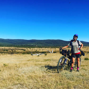 Day 1 - Denison camping ground to Mackey's Hut Distance: 31km Elevation gain: 831 m Strava link Campsite: Mackey's Hut Highlights:
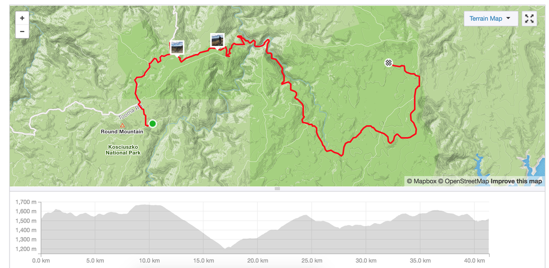
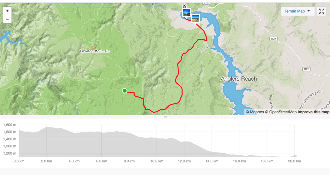
 Day 2 - Mackey's Hut to Round Mountain Hut Distance: 32 km Elevation gain: 834 m Strava link Highlights:
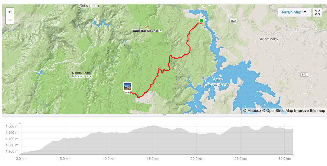
 Day 3 - Round Mountain hut to Happy's hut Distance: Elevation gain: Strava link Highlights:
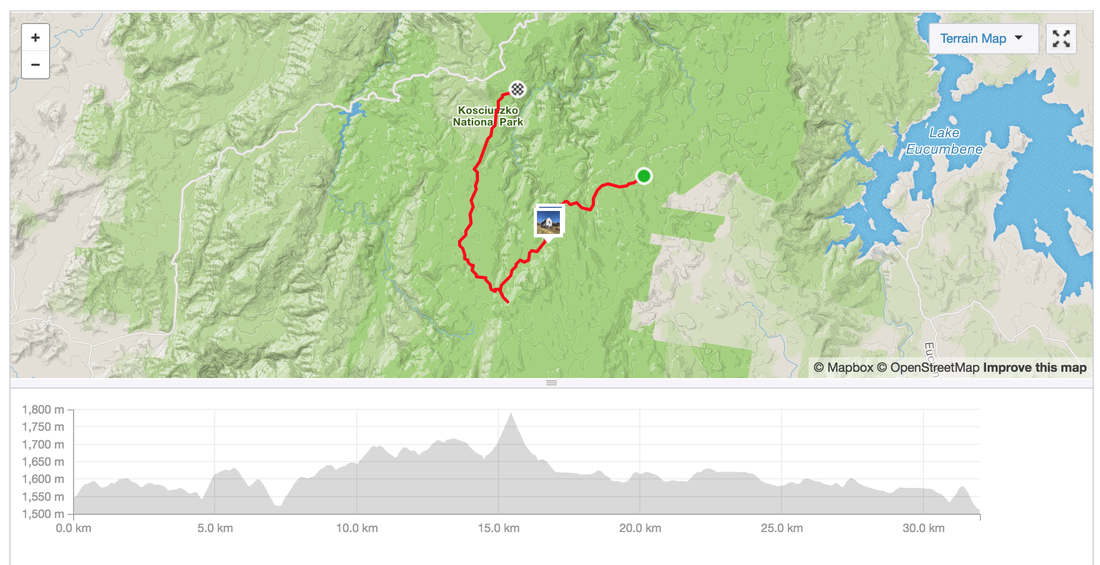
 Day 4 - Happy's hut to Denison camping hut Distance: 20 kms Elevation gain: 216 m Strava link Highlights:
 List of links for Safer Streets:
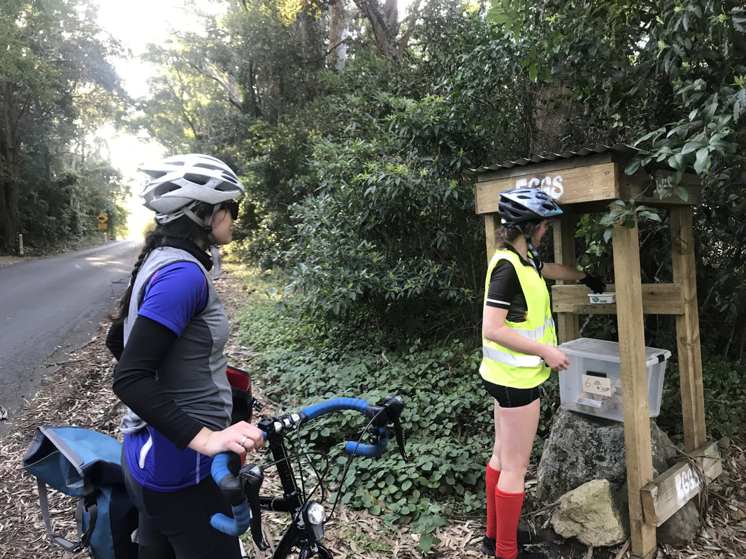
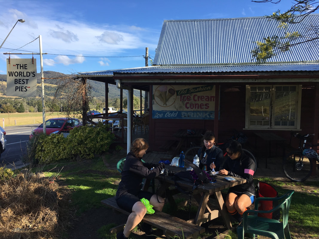
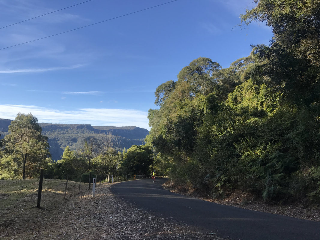
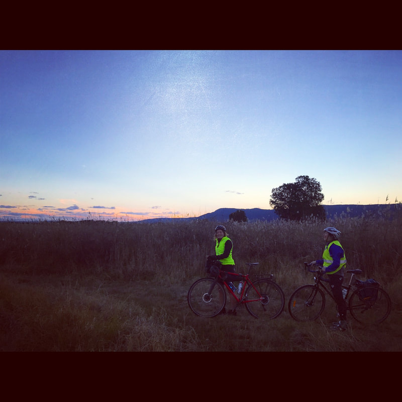
Every 6 months or so I want to see all the rides I've made in one map. I've painstakingly exported rides from Strava and then imported them into cartodb. No more. Jonathan Okeeffe has created a Strava app to do this. Using the Strava api to get all rides for a given user (access to data requires authorisation). www.jonathanokeeffe.com/strava/map.php 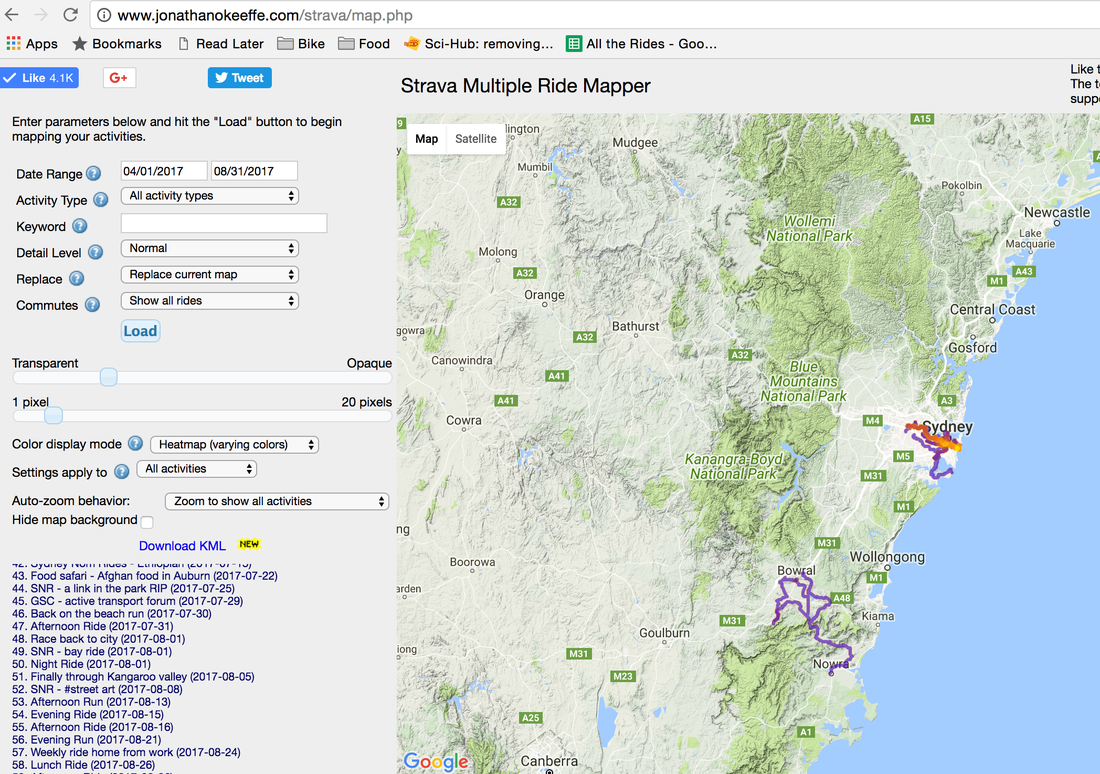 Going down to the Southern highlands has been a favourite weekend getaway for me these past few years. But I didn't have the guts to ride through to the East Coast, mostly because keep telling me about the epic climb out of the valley and the nastiness of the roads. Single lanes, no overtaking, hair pins and epic decent. Luckily a few girlfriends were up for an adventure last weekend and we managed to tackle it with only a few minor incidents. Starting Point: 7:15am train from Redfern station to Mittagong station Ride start point: Mittagong station Finish Point: Friend's place in Nowra Distance: 104km Elevation: 1,464 m Route: link Pitt Stops: 1. Cafe at Mittagong 2. Barrengarry primary school 3. Kangaroo Valley in the valley where I bumped into a work colleague 4. Kangaroo Valley pie shop with the world's greatest pie 5. Eggs at the top of the climb 6. Berry 7. Swamp road trekking through all the marsh  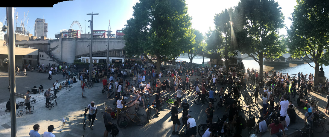
Critical Mass London is epic. Hundreds of riders of all ages, colours, bikes, music tastes rolling together.
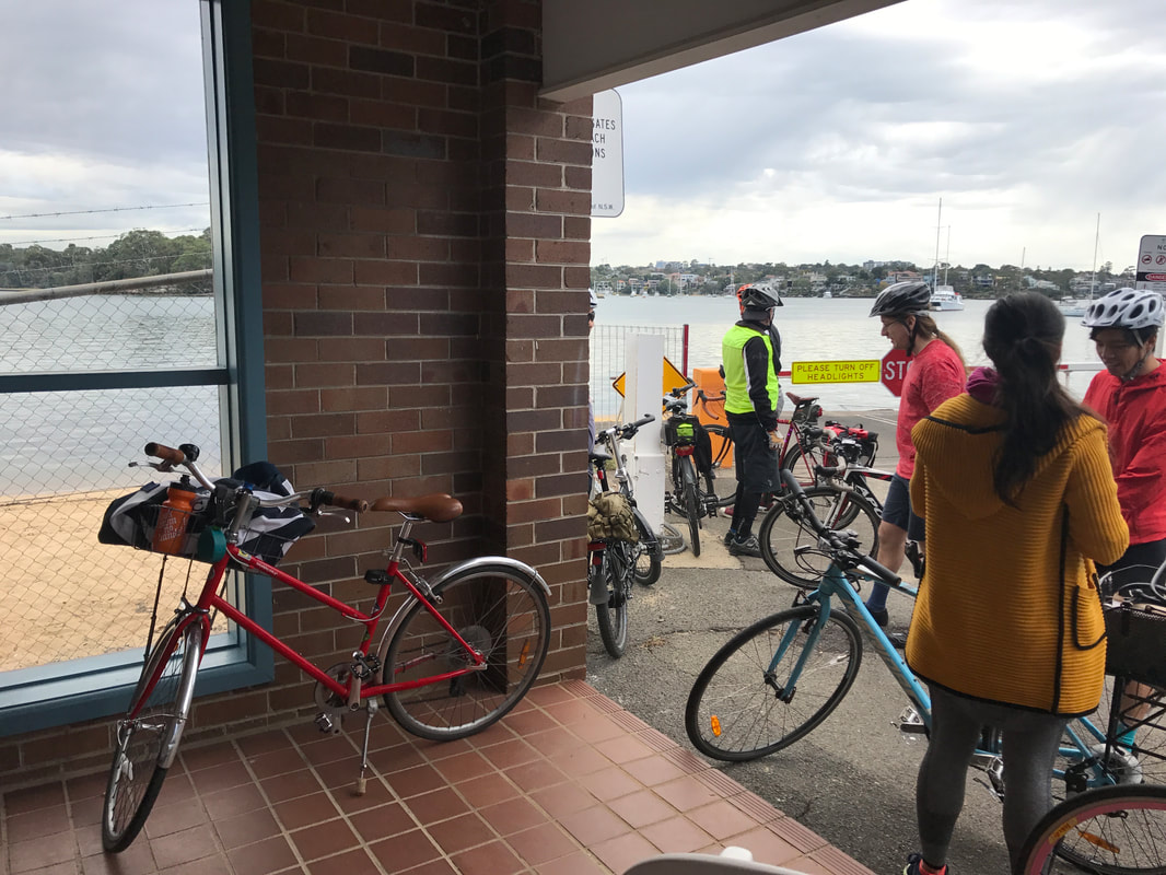
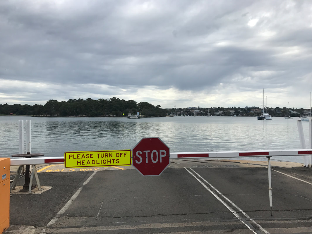
Last Friday of every month, South Bank under Waterloo Bridge 6.00pm to leave 6.30pmCheck out their website network23.org/criticalmasslondon/ for latest info. Critical Mass London from Jules on Vimeo. 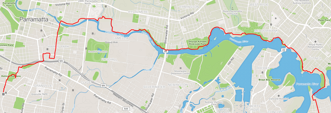 It's now possible to ride or walk off road for 10 kms along the northern side of Parramatta river (Parramatta to Putney)! Thanks to a new bridge across Subbiaco creek the shared path allows people to travel safely to and from Parramatta without ducking into the industrial areas of Rydalmere. Before Subiaco creek connection Bike riders would have to ride 500 metres on road in an industrial area between Rydalmere and Parramatta. It's not much, but it's still off putting enough for those with children and not confident riding in traffic. 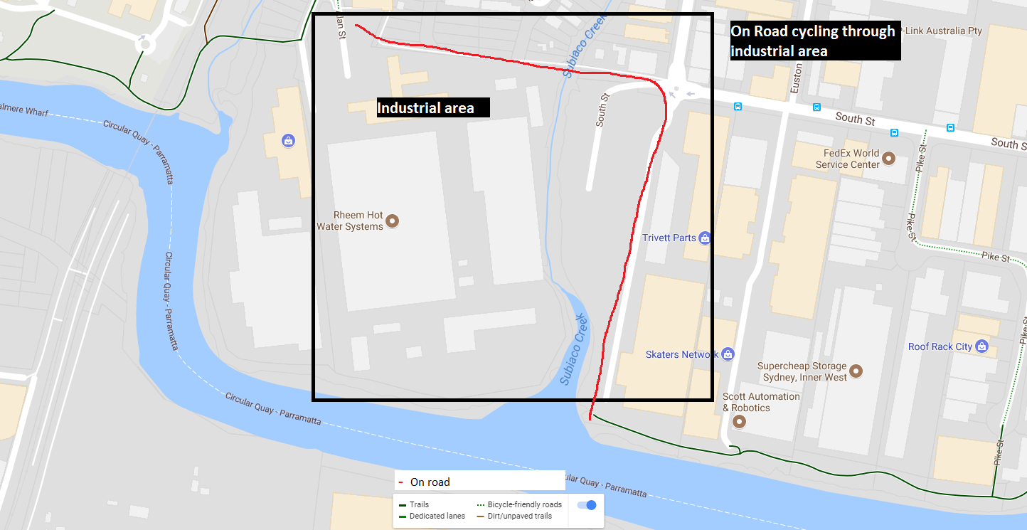 After Subiaco creek connection Bike riders can ride off road, along the river for 10 kms from Parramatta to Putney! 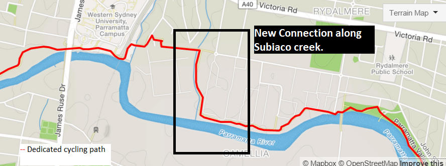 I took the opportunity over the weekend to travel from the City to Merrylands (Check out the post on Sydney Nom Rides). The route was half on road cycle path and off road, and interestingly included a "punt" (a ferry to transport vehicles and people) across Parramatta rived between Mortlake (Breakfast point) and Putney. The Putney punt has been operating since 1925, it's free of charge to use, operated by RMS. Operates all day on weekends and only during peak hours on weekdays. It's basically a platform on cables that moves back and forth by 2 operators and was built because it was cheaper than building a bridge. Check out the Strava link for route details.  Maps
Cycle touring in Scotland is amazeballs. I picked up a Sustrans map of the National Cycle Network of the United Kingdom from Stanfords Maps in London (the best map store ever). Looking at it there were so many routes to chose from, in the end I decided to follow route 1 from Edinburg along the east coast to Inverness, then south back to Edinburgh. However after a day of riding in hail to Inverness I was done. Bought a train ticket back to Edinburgh and enjoyed the scenery from the train through the mountains. Wild Camping I had brought my own tent and sleeping bag. I didn't bring cooking utensils luckily as there were plenty of places to eat at along the way. Thanks to Scotland's "Open access" law you're allowed to camp on open spaces just as long as you leave no trace and don't set up anywhere close to private residences. https://www.visitscotland.com/accommodation/caravan-camping/wild-camping/ The birthplace of Golf I quickly learnt that Scotland is the birth place of golf. So so many golf courses along the coast that have great provisions for cycling along the perimeter with spectacular views. |
Archives
July 2023
Categories
All
|


 RSS Feed