|
I just moved to a new area and begins the process of finding the best route to get anywhere. Good luck to any one new in Sydney let alone old time Sydney siders trying to figure out where the buses go. The Sydney Buses website lets you download a Pdf after you select the bus route number.
They assume you magically know what the route number is 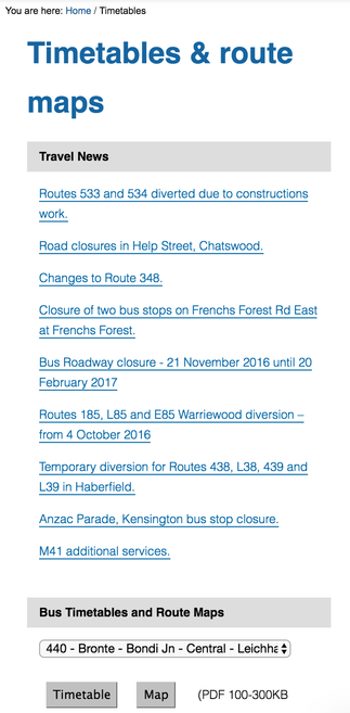
An interactive map with all modes of transport
I want to be able to see what modes of transport are available in my area so I just start plotting away.
I used carto to quickly plot out some networks.
0 Comments
I've been playing around with Mapbox this weekend and am loving it. I spent a week cycle touring through Moss Vale to Albury in New South Wales so all the trips were recorded on different files in the garmin and uploaded into strava. Some of the route deviated from the original plan. The data for 2 days was mashed up into 1 file. Argh, how to get it all nicely into one map with all the camping sites, interesting bits and pieces we found along the way?
Boom, mapbox. 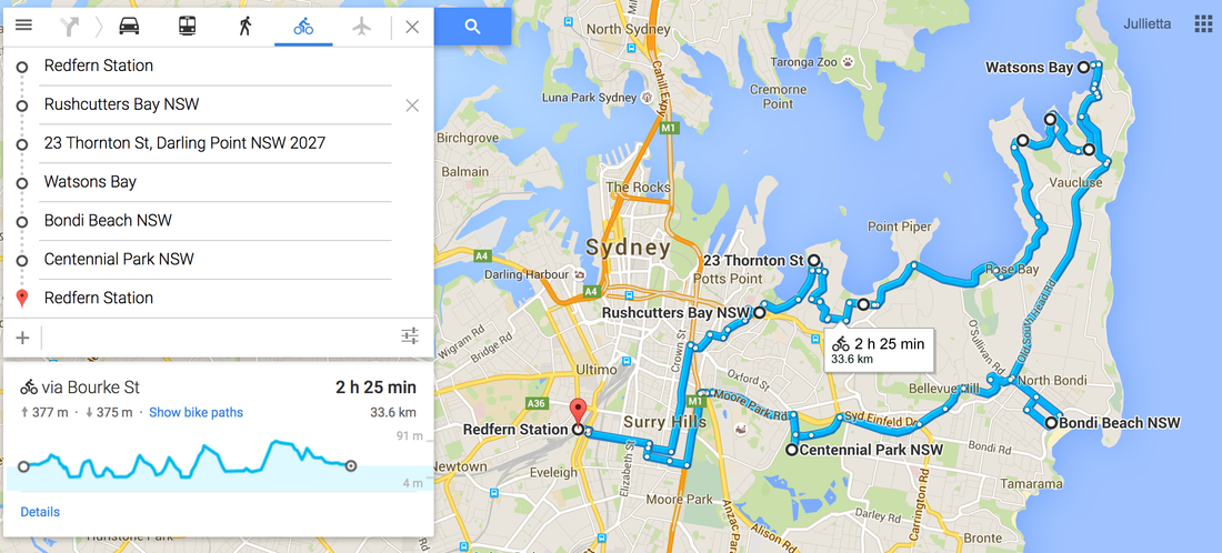 I've been organising bike rides for the past few months now and growing frustrated with the lack of mapping technology that allows me to find a bike route and GPS navigate it on a ride.
Most maps the councils provide are pdfs so not very interactive. So I find myself either trying to take photos of a map and trying to memorise it or using google maps to guide me as best as I can. I'm looking forward to Google's Mapmaker relaunch this month - which should make adding more mapping data easier. News and Announcement made here - https://productforums.google.com/forum/#!category-topic/map-maker/news-and-announcements/fY-Cu6355pM My first mission once it gets relaunched is to add more bike paths to help people cycle around on safer streets and with more confidence. Check out this NYC mapper mapping bike and walking paths - http://www.wnyc.org/story/284082-now-you-can-edit-google-maps-add-bike-walking-paths/ I received an email recently to engage with Planning NSW's latest community engagement initiative. I was bracing myself for some hideous online survey with hundreds of questions. So was pretty thrilled to see this interactive map with drag and drop pins to let the department know:
I love the language choice of these 2 simple options. Don't be negative and just hating on things. Give some real feedback and think about how you can solve a problem (change). 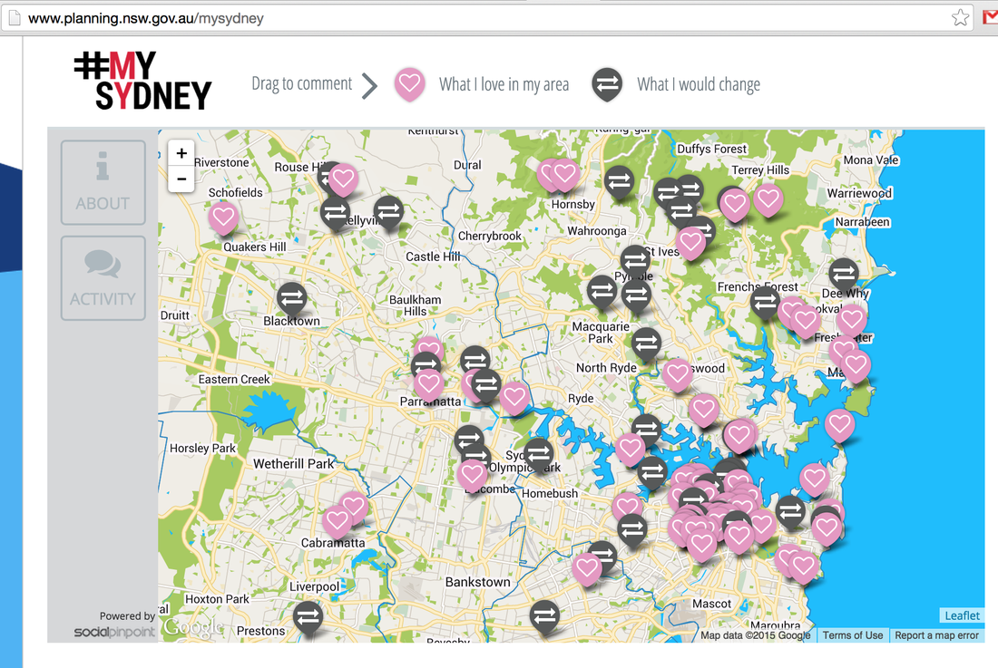 Planning NSW is using SocialPinPoint for its latest round of community engagement Social Pin Point lets you easily collect community opinion with an interactive map that lets users drop a pin with comments which are searchable and locate-able. Forget the post-it notes and gigantic maps at your next community engagement meeting. Just bring a few laptops or iPads and get users to zoom in on the virtual map and give instant comments for change or kudos. See what others are saying about the area and use the "likes" and "dislikes" icon to agree or disagree with other comments. Social Pin Point's website. Planning NSW's #mysydney engagement. 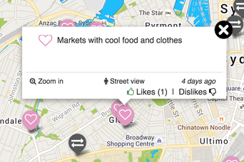 Someone's pin for the Glebe Markets has 1 Like and 0 Dislikes. |
AuthorBlogging about all things that create beautiful healthy communities, active transportation and tech. Archives
January 2019
Categories
All
|
 RSS Feed