Jullietta Jung
  • Me
  • Cycling
  • Blog
  • Map

Moss Vale to Albury, NSW in 7 days

12/5/2016

0 Comments

 
liFinal stats
Total Distance: 622 kms
Total Elevation gain: 7,760 m
Highest Peak:1,500 metres above sea level at Selwyn Snowfields
Coldest point: Selwyn Snowfields, 6 degrees, felt like 1 (evidence in the ice that formed in our drink bottles)
Fastest speed: 59 kms/h
Fires we made or leeched off others: 6
Successful dampers made by the fire: 0
Muesli bars consumed: 14
 
Favourite moment: Riding with a brumby
Least favourite: All the gravel

View the posts for the whole journey: ​link
Posts
Day 1 - Moss Vale to Bungonia - link
Day 2 - Bungonia to Canberra - link 
Day 3 - Canberra to Mount Clear via Bobeyan Road - link
Day 4 - Mount Clear to Selwyn Snowfields - link
Day 5 -  Selwyn Snowfields to Tamburamba - link
Day 6 - Tamburamba to Jingelic - link
Day 7 - Jingelic to Albury - link

Ride with GPS
Day 1 - Moss Vale to Bungonia - link
Day 2 - Bungonia to Canberra - link 
Day 3 - Canberra to Mount Clear via Bobeyan Road - link
Day 4 - Mount Clear to Selwyn Snowfields - link
Day 5 -  Selwyn Snowfields to Tamburamba - link
Day 6 and 7 - Tamburamba to Jingelic - Albury - link
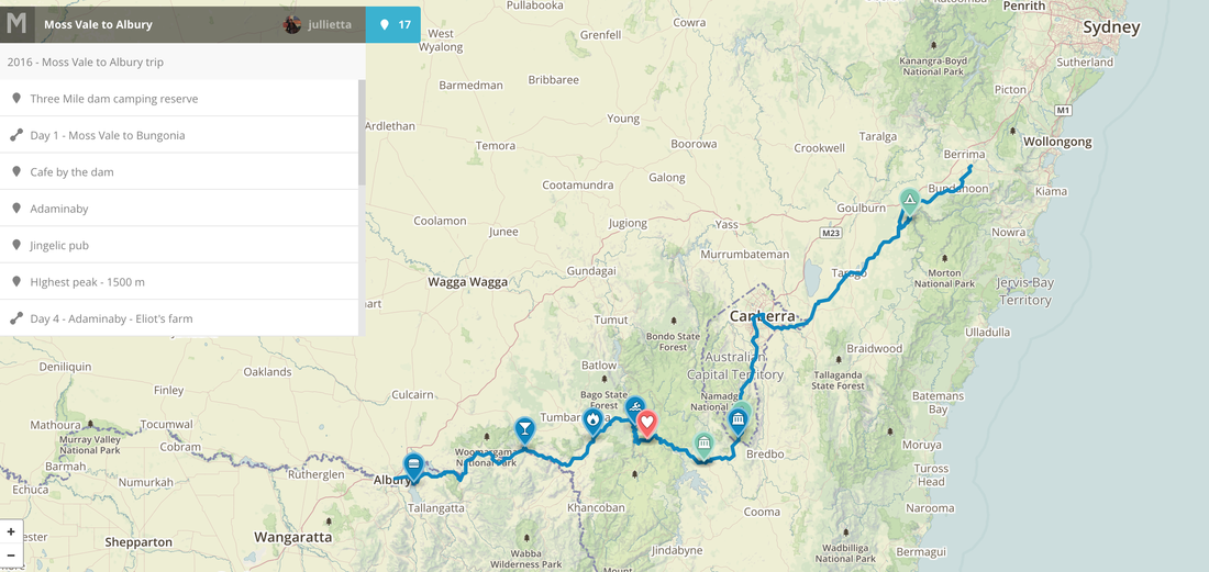
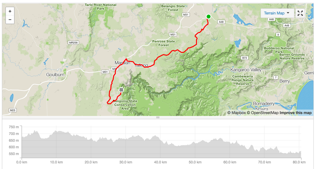
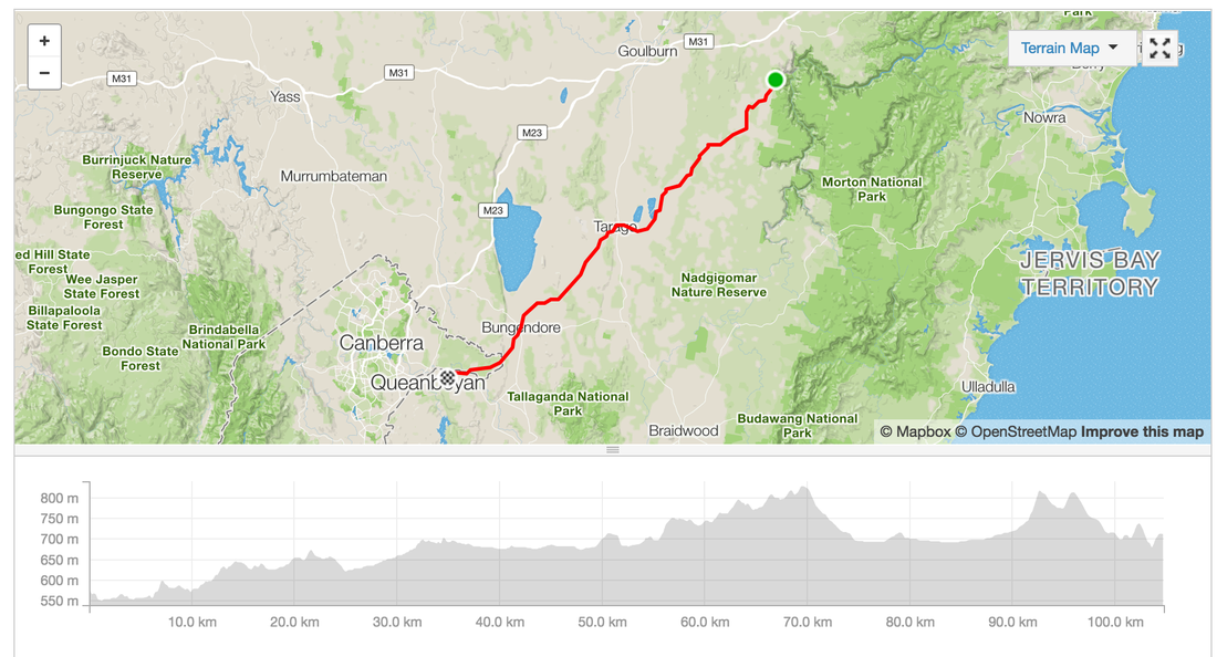
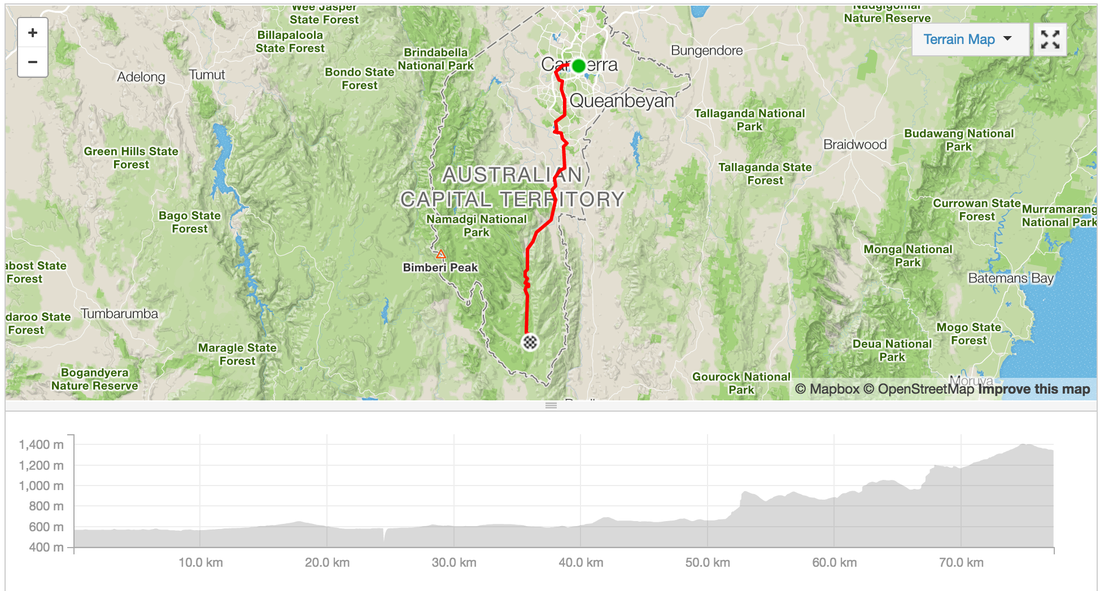
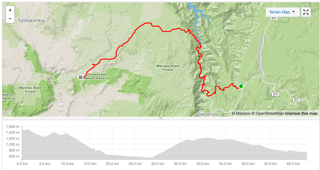
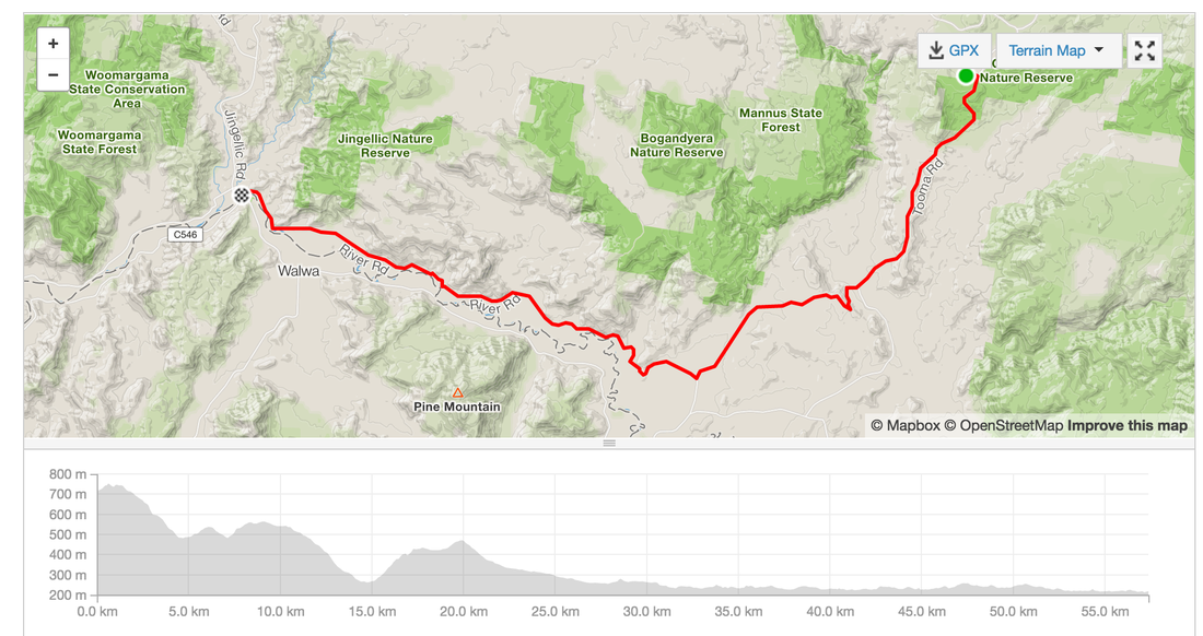
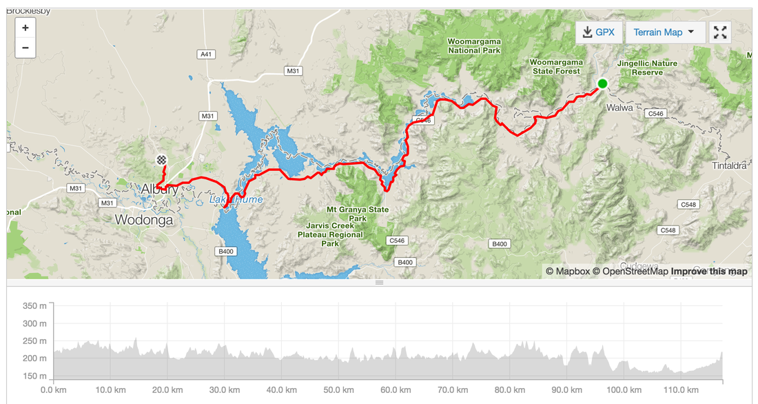
Picture
Picture
Picture
Picture
Picture
Picture
Picture
Picture
0 Comments

Day 4 - Mt. Clear to Selwyn Snowfields, close call finding a camping spot before freezing

26/4/2016

0 Comments


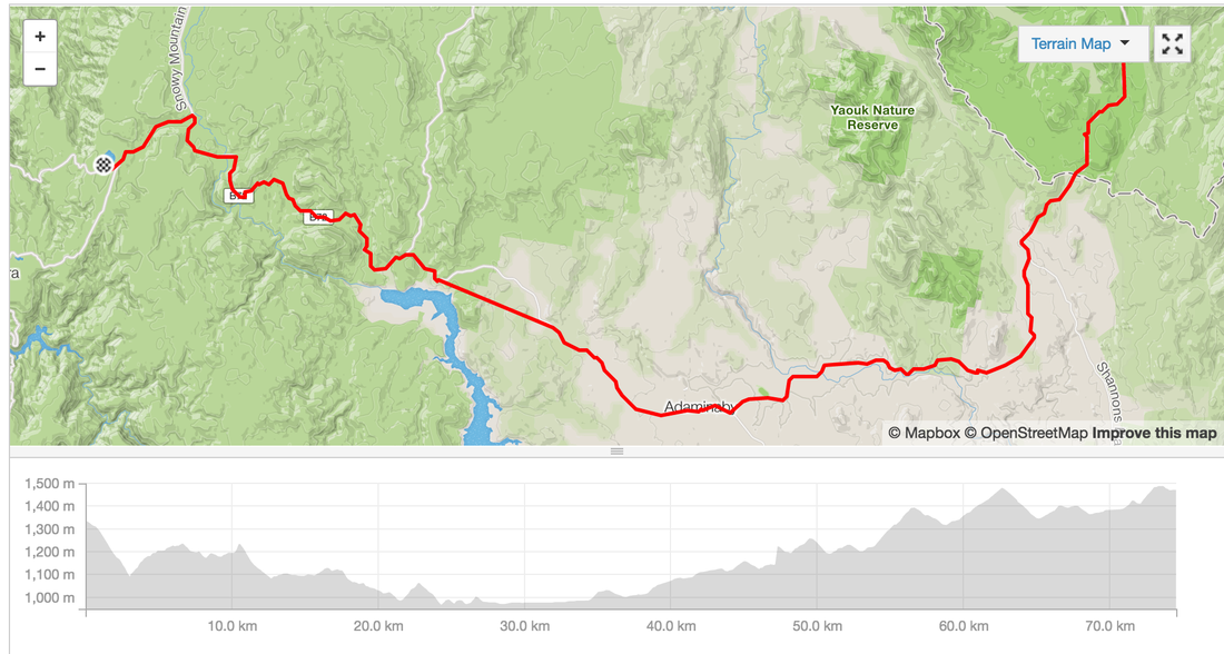
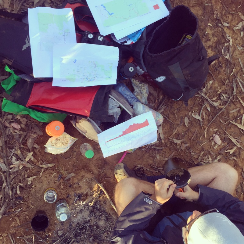
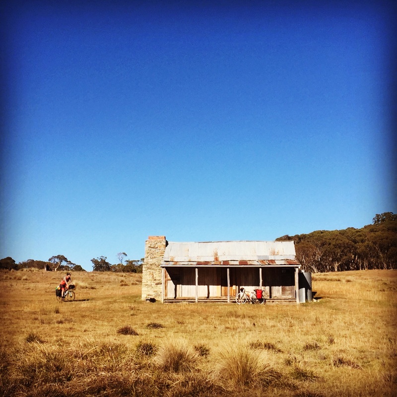
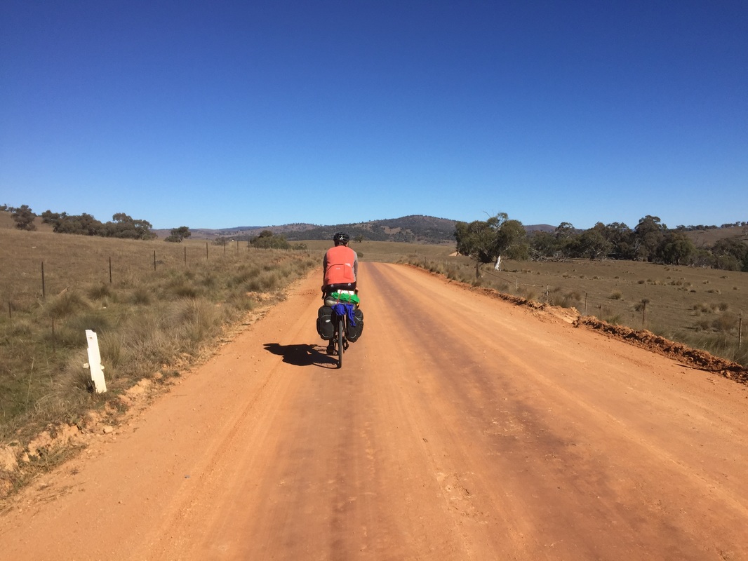
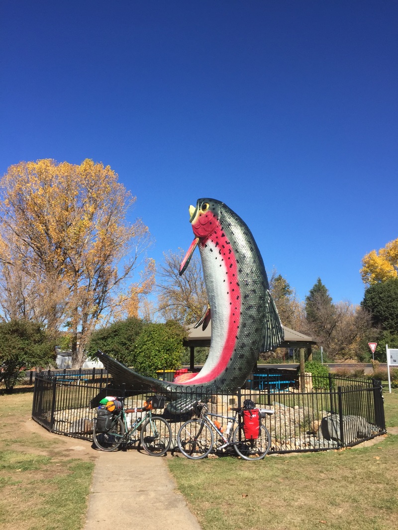
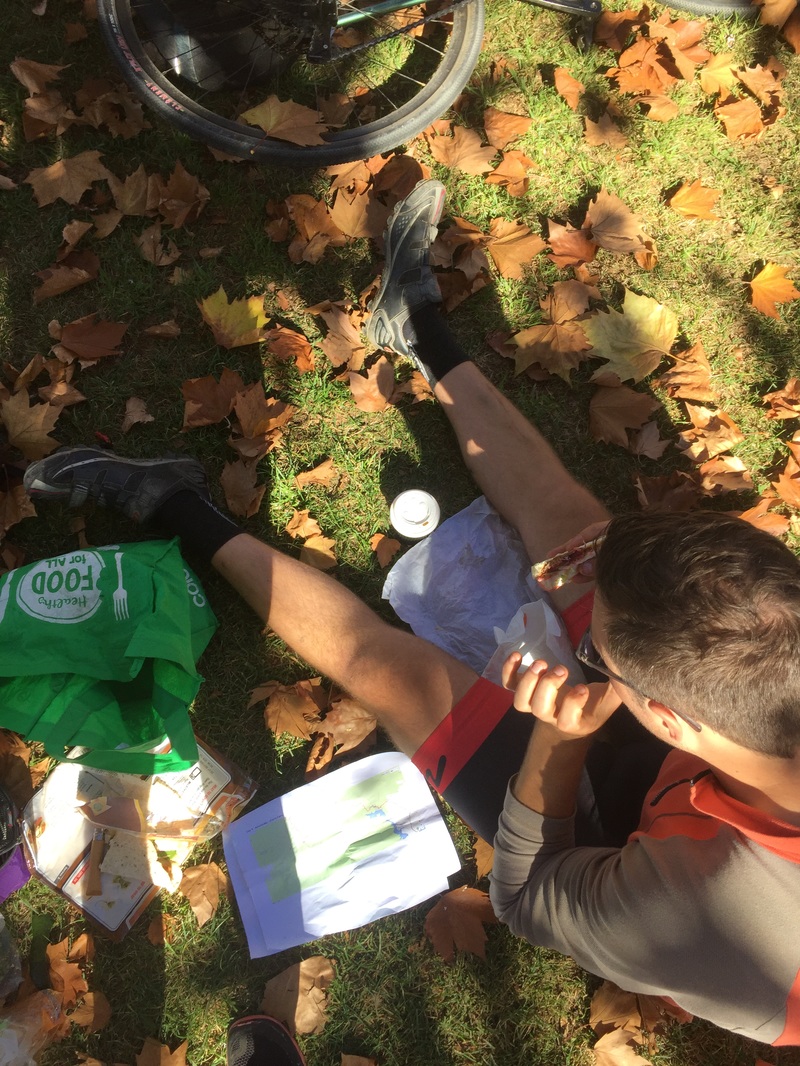
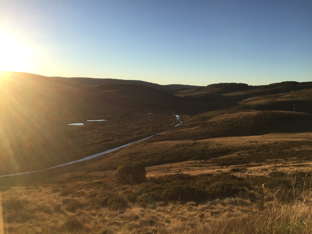
Wake up after a freezing cold night. Luckily we have enought fuel for a fire to warm some water to make porridge. However the gravel road out of Canberra along Bobeyan road is soul crushing. Our patience is thinning. We're not talking to each other and ready to burst.

​We make it out by 12pm and roll into Adaminaby for lunch. We sit eating in the fallen Autumn leaves planning the next section. We thought we'd be able to make it to O'Hare's rest area, but as the sun went down and still had 30 kms to go we realised there'd be no chance. Plan b get to a warmer flat ground, outta sight camp-able spot before we freeze. Hangry and cold we pass a sign for Selwayn Snowfields and come across a sign with the tent symbol, Three Mile Dam camp grounds. SCORE! We roll in and see several campervans with fires going and we're more at ease. The night gets better as we get invited to share the fire of our neighbouring campers who also have keen cycling children and are keen adventurers. Another close call.


Distance: 74.5 kms
Elevation: 1,478 m
Difficulty: Hard
Road: Gravel 43 kms, on road, beautiful decent into Kiandra goldfields
Strava: link
Start: Mt Clear
End: Three Mile Dam Campground near Selwyn Snowfields
Food: Lunch @ Adaminaby, cafes, bakery, pub, bowling club, general store with camping gear

Highlights:
  • Brayshaw's settler's hut in Shannons flat
  • The big trout at Adaminaby 
  • Finding a gas canister for my stove so we can make coffee​
  • Sharing a campfire with a friendly couple on the campsite
  • Cafe in Adaminaby

Anit-highlight
  • 43 kms of gravel roads, corrugated to get to Adaminaby
Picture
0 Comments

    Archives

    January 2023
    May 2022
    March 2022
    January 2022
    November 2021
    October 2021
    May 2021
    April 2021
    March 2021
    September 2020
    May 2020
    April 2020
    January 2020
    October 2019
    June 2019
    March 2019
    January 2019
    December 2018
    September 2018
    August 2018
    April 2018
    January 2018
    August 2017
    July 2017
    June 2017
    May 2017
    April 2017
    March 2017
    December 2016
    August 2016
    June 2016
    May 2016
    April 2016
    January 2016
    December 2015
    November 2015
    October 2015
    September 2015
    August 2015
    July 2015
    June 2015
    May 2015
    January 2015
    December 2014
    November 2014
    October 2014
    August 2014
    July 2014
    June 2014
    May 2014
    January 2014
    November 2013
    October 2013

    Categories

    All
    Aberdeen
    Adaminaby
    Adelaide
    Albury
    Amsterdam
    Apps
    AttackOfTheBuns
    Australia
    Balmain
    Banff
    Beach
    BigData
    Bike
    Bikecafe
    Bikehire
    Bikelane
    Bikensw
    Bikepacking
    Bikepath
    Bikeriding
    Bondi
    Bowral
    Brighton-le-sands
    Buildings
    Buller
    Bundanoon
    Bungonia
    Cabramatta
    Camping
    Canberra
    Canterbury
    Cargo
    CoastalRide
    Coffee
    Commute
    Cronulla
    Cycle
    Cyclehack
    Cyclelogistics
    Cycletouring
    Cycleway
    Cycling
    Doublebay
    Doverheights
    Dundee
    Economic Development
    Enmore
    Erskineville
    Europe
    Findhorn
    Fire Trails
    Food
    Garden
    Garmin
    Gears And Beers
    Germany
    Glebe
    Gps
    Granville
    Gravel
    Helmetfreedom
    Hills
    Hut
    Infrastructure
    Inverness
    Italy
    Jagungal
    Japan
    Jingelic
    Kangaroo Valley
    Kosciuszko
    Ku Ring Gai
    Ku-ring-gai
    Kyoto
    Lithgow
    London
    Manly
    Mapmyride
    Mapping
    Markets
    Mittagong
    Moss Vale
    MossValeToAlbury
    NationalPark
    Nature Ride
    Navigation
    Netherlands
    Newcastle
    Night Ride
    Nightrides
    Nowra
    NSW
    NYC
    Offroad
    Olympicpark
    Osaka
    Outsideiffree
    Pacific Coast Cycleway
    Parramatta
    PCCAMS18
    Pedestrians
    Railtrail
    Rapha
    Redfern
    RNP
    Royalnationalpark
    Sans Souci
    SBS
    Scotland
    Seaside
    Selwyn Snowfields
    Sento
    Shinto
    Southern Highlands
    Stirling
    Strava
    Surryhills
    Sutherland
    Switzerland
    Sydney
    Sydneynightrides
    Sydneyrides
    Tasmania
    TDF2015
    Tech
    Technology
    TourDeFrance
    Tourist Attraction
    Train
    Tumbarumba
    Urbanist
    Urban Planning
    Utrecht2015
    UvA
    Victoria
    Video
    Wagga Wagga
    Watsonsbay
    Windsor
    Wisemans Ferry
    Wollindilly
    Wollongong
    Wombeyan
    Wombeyan Caves
    Wyong

    RSS Feed

  • Me
  • Cycling
  • Blog
  • Map
Proudly powered by Weebly