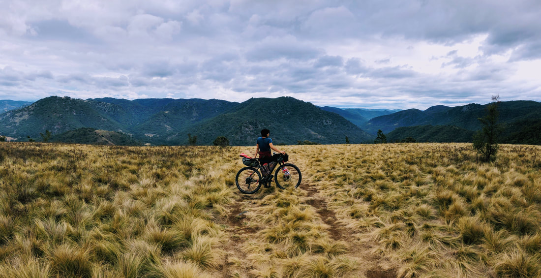
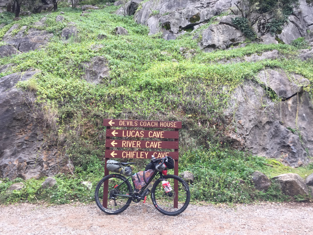
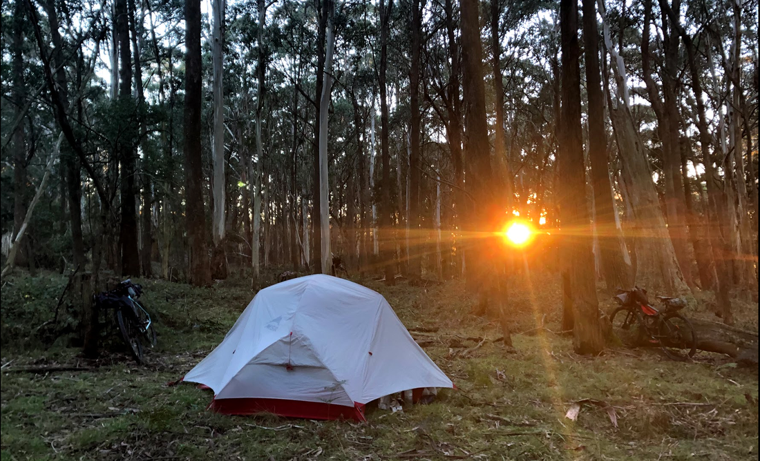
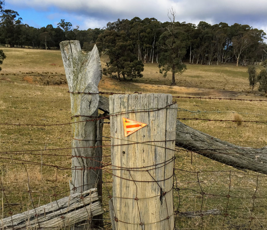
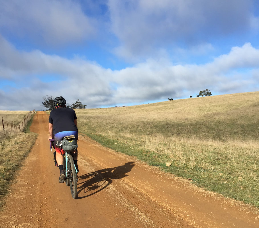
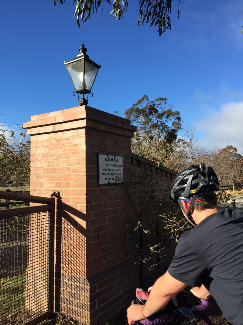
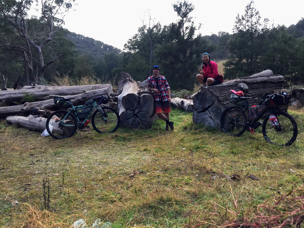
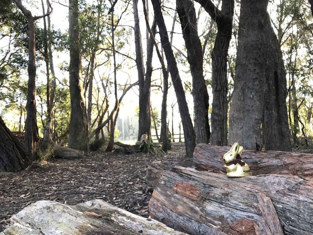
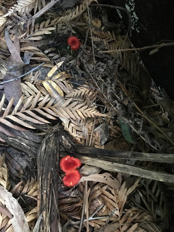
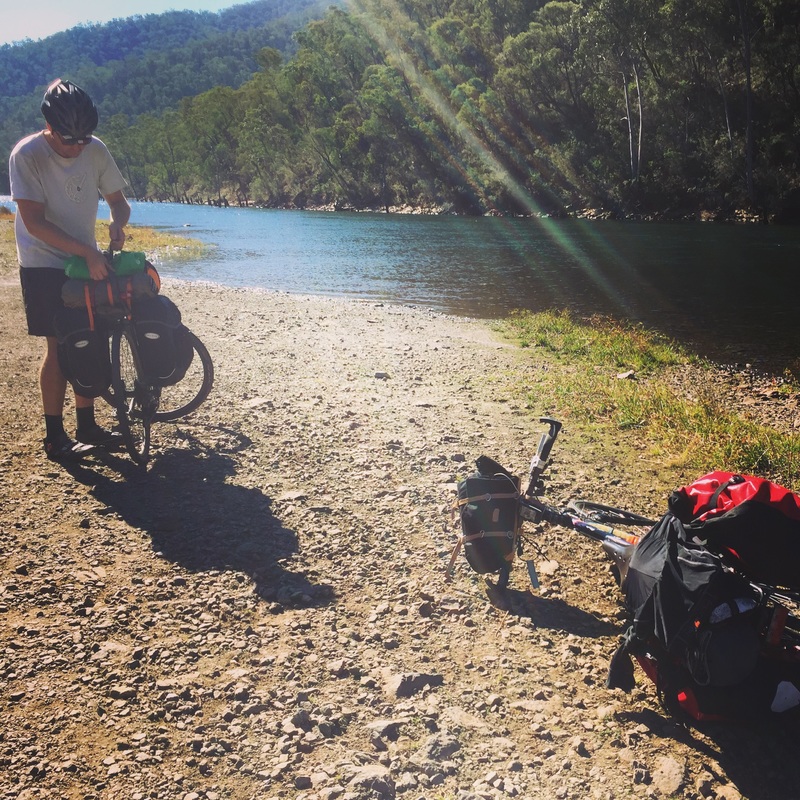
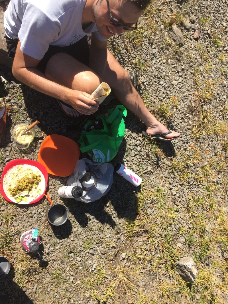
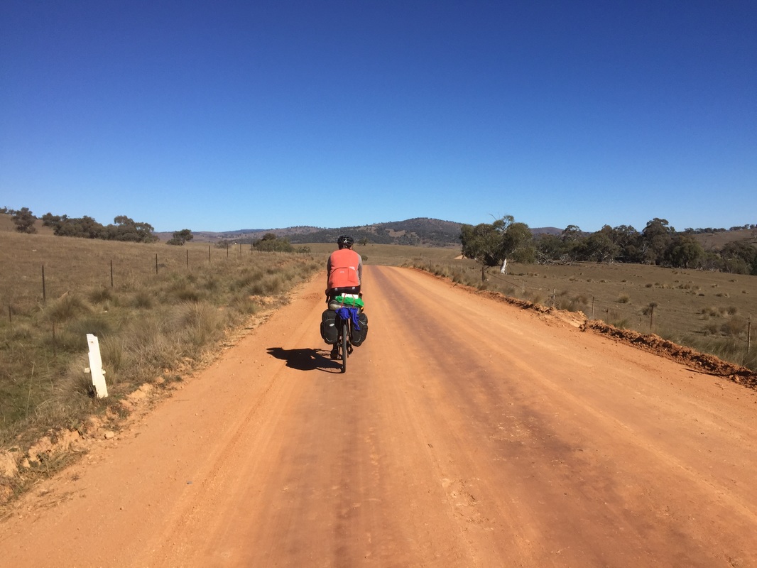
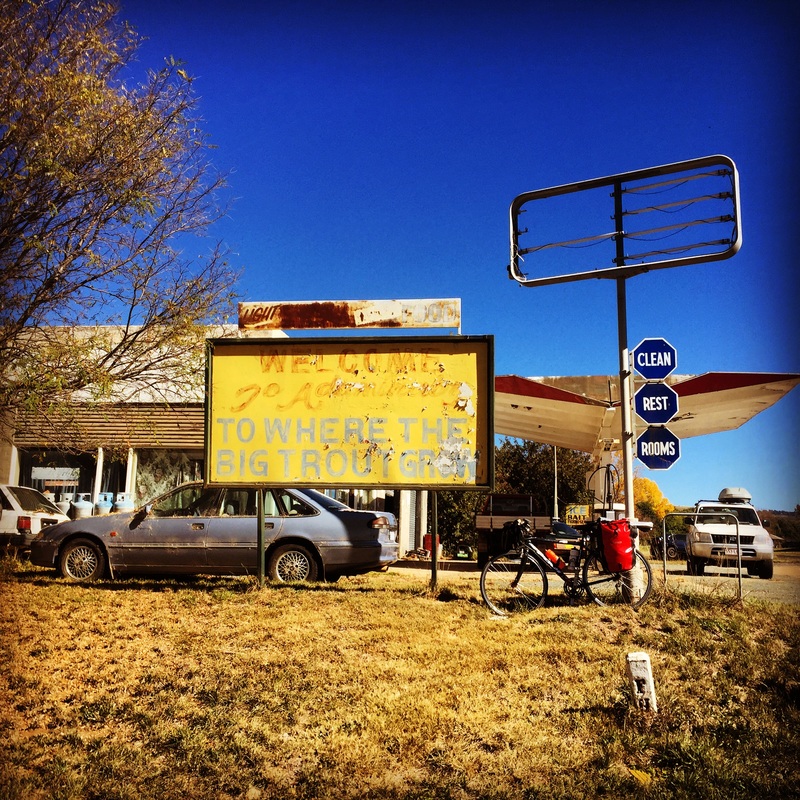
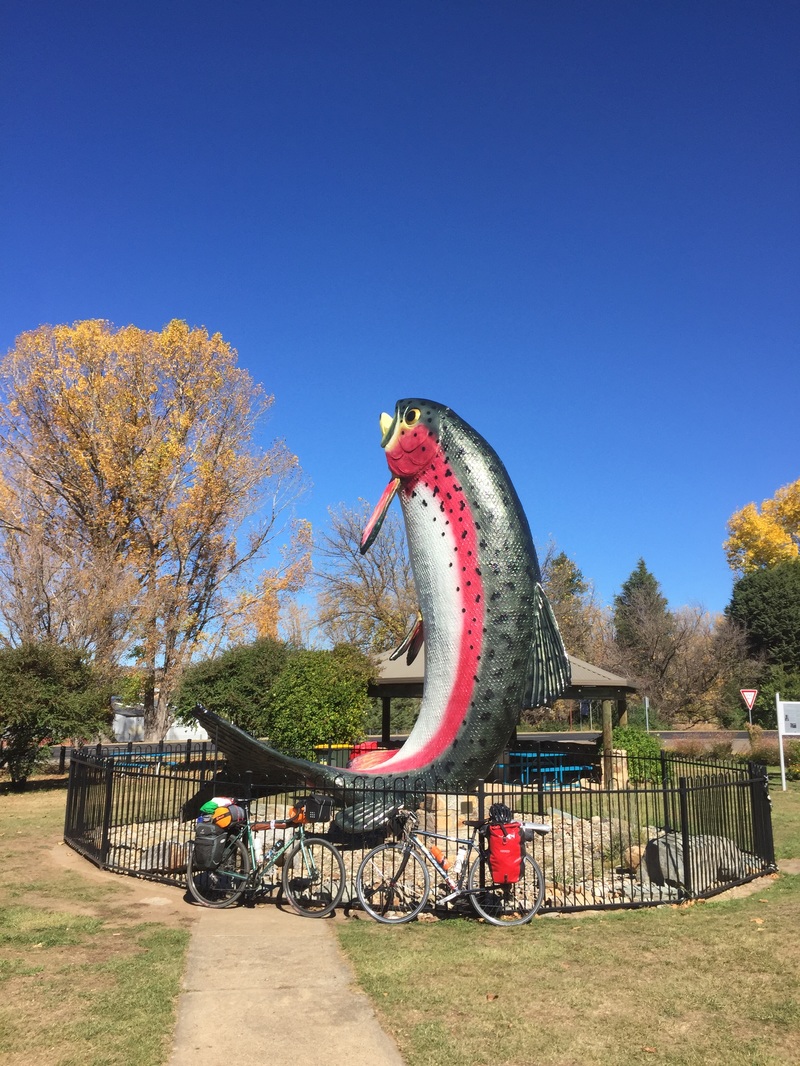
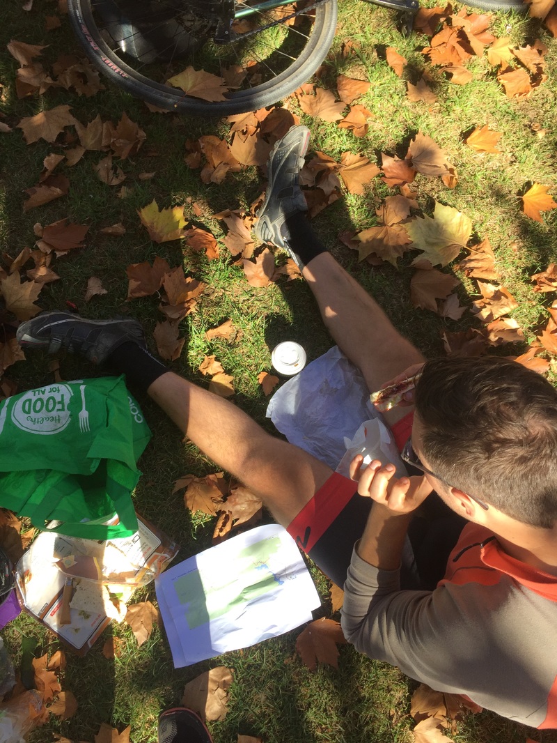
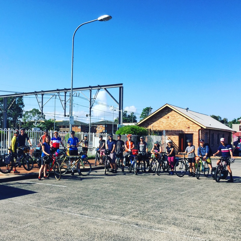
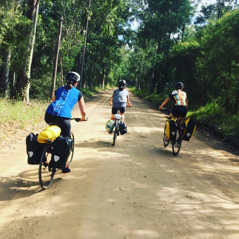
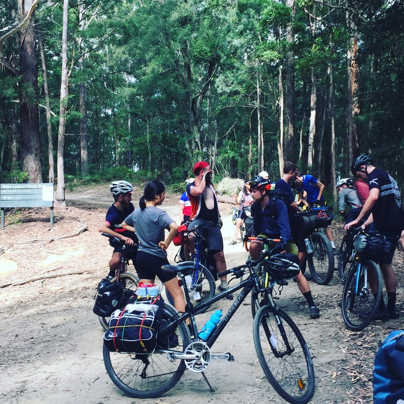
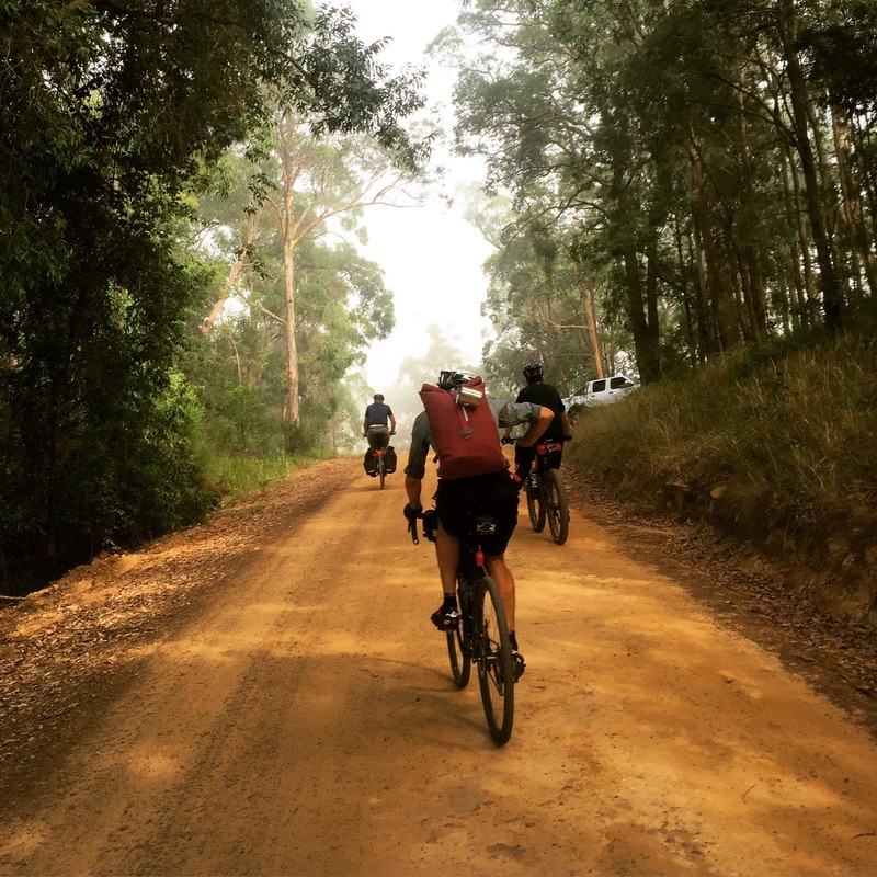
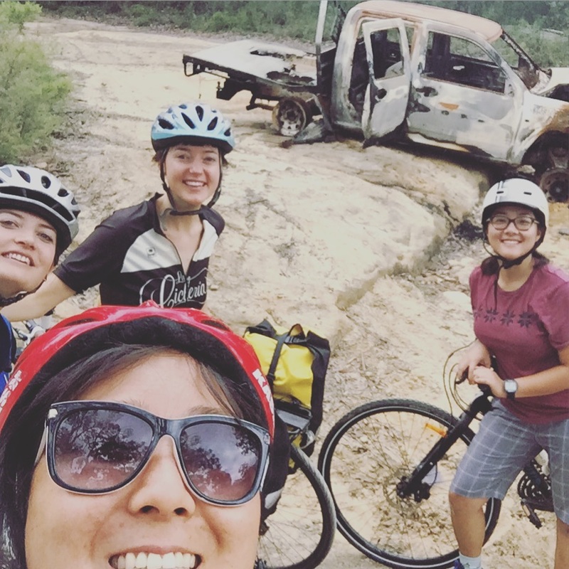
 Despite all the planning and ideating the weeks prior to the June long weekend the final route wasn't finalised till midnight before the ride. A few hiccups along the way included initially mapping out a route that potentially had no water refills, then accidentally creating a route through the restricted area around Lake Burragorang. In the end it was decided 5:20am train to Lithgow and ride out to Mittagong. Day 1 - Lithgow to Shooters Hill via Jenolan Cave Strava link Distance: 66.87 km Elevation: 1,568 m Riding time: 4h 28m Beautiful bits: the decent into Jenolan Caves, wedges at the cafe at Jenolan, camping in the state forest Shitty bits: the freezing cold chill (the kind where you think your fingers and toes will snap off), big vehicles on the narrow roads, guns shots in the middle of the night (thankfully I didn't actually shit my pants but I was close). Food Breakfast: avo bagels on the train Morning tea: apple pie from the Lithgow cake shop, picked up more rolls for later Lunch: Avo + tuna rolls, Avo + tofu rolls Afternoon snack: Soy chai, coffee and chips at the Jenolan caves kiosk Dinner: Lentil dhal and rice in one pot. 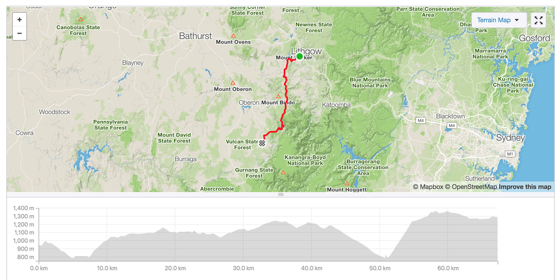 Day 2 - Shooters Hill to Wombeyan Caves through state forests Strava link Distance: 74.93 km Elevation: 1,189 m Rolling time: 5h 8m Ave speed: 14.6km/h Beautiful bits: Morning sunrise in the state forest, lunch by the fire at Werong camp site, decent into Wombeyan Caves, 2 ice-creams at the kiosk Shitty bits: coffee in oats (very, very bad), google navigating onto private roads, drones and dirt bikes on the camp site Tips: If lost, look out for the Bicentennial trail signs Food Breakfast: oats + nuts + coffee Morning tea: Jules' muesli bars Lunch: Avo + tuna wraps, Avo + tofu wraps Afternoon snack: 2 ice creams each from the Wombeyan kiosk Dinner: Coucous with sultanas, fried eggplant, felafel in tomato sauce 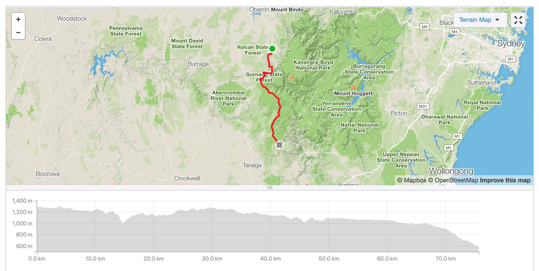 Day 3 - Wombeyan Caves to Mittagong via Wollindilly River Strava link Distance: 65.77 km Elevation: 1,049 m Rolling time: 3h 57m Average: 16.6km/h Beautiful bits: breakfast with the roos, slow gentle climbs, lunch at Wollondilly lookout Shitty bits: freezing hands Food Breakfast: oats + nuts, coffee (separately) Morning tea: Jules' muesli bars, trail mix, dried avos Lunch: Avo + tuna wraps, Avo + tofu wraps Afternoon snack: beer from the Mittagong pub 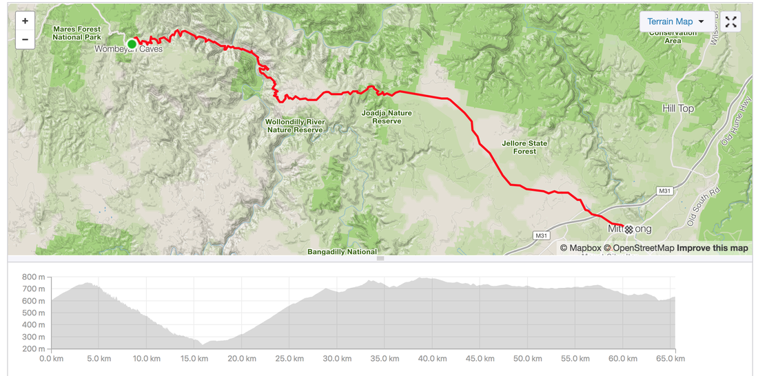 Tips: 1. Check the restricted areas / access with NSW Water 2. Check if hunting is allowed where you're camping, the Department of Primary Industries website 3. Check if google has mapped you onto a private road on six maps 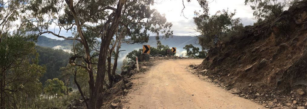
0 Comments
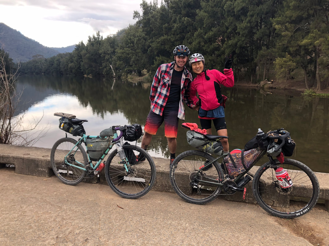
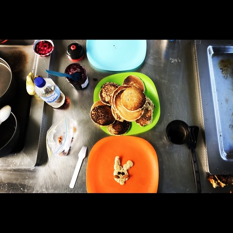
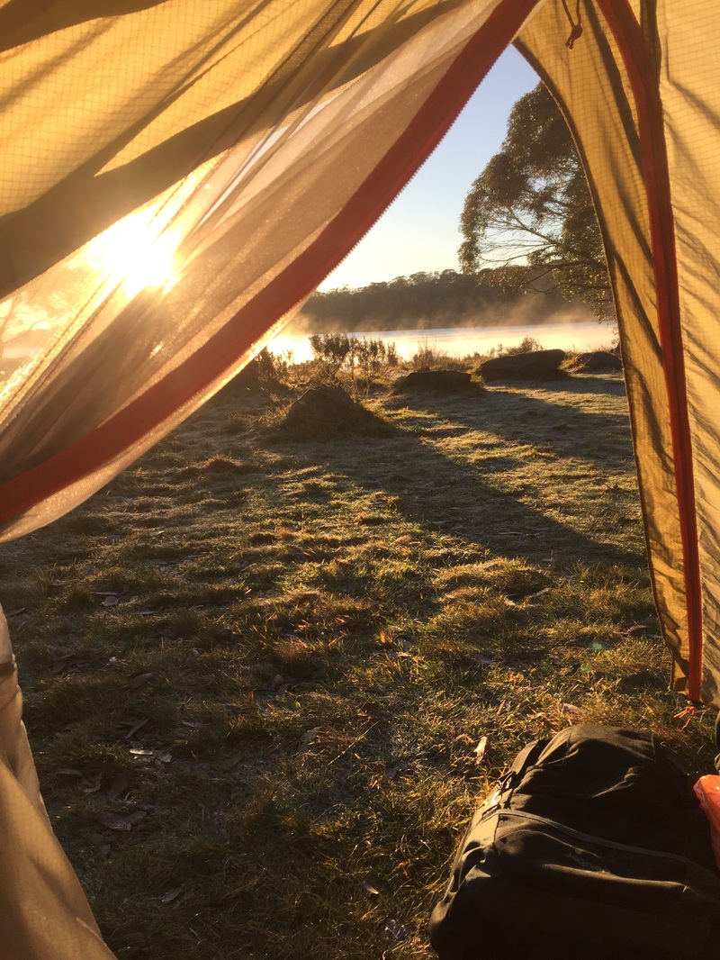
Maps
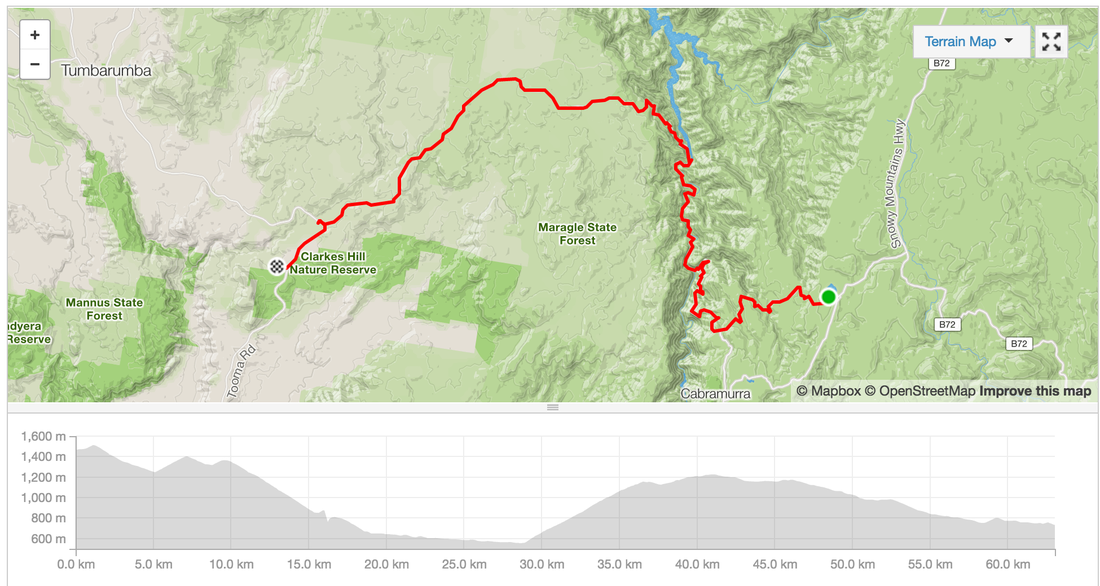
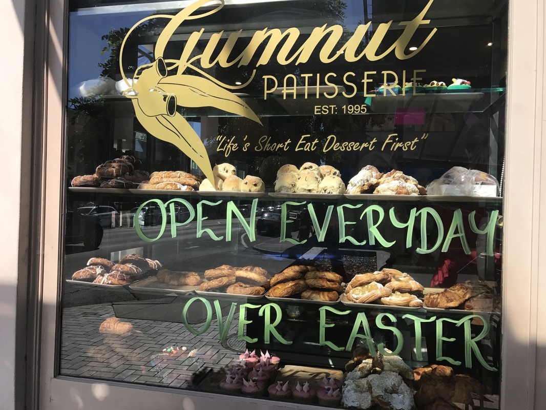
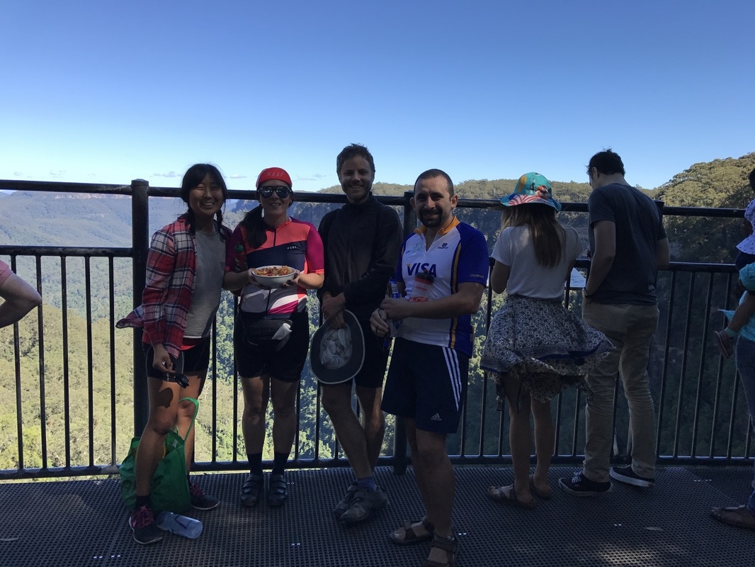
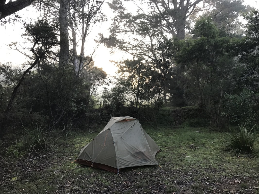
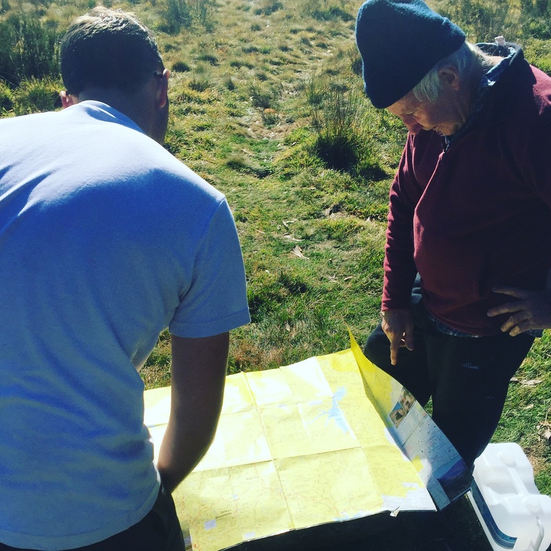
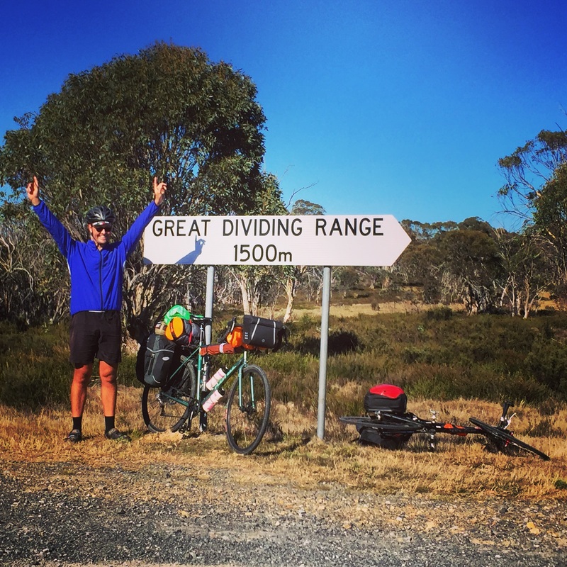
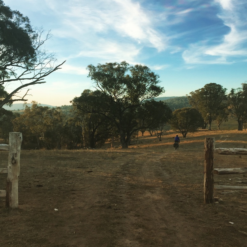
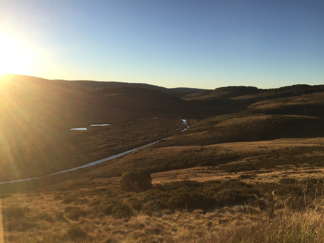
Cycle touring in Scotland is amazeballs. I picked up a Sustrans map of the National Cycle Network of the United Kingdom from Stanfords Maps in London (the best map store ever). Looking at it there were so many routes to chose from, in the end I decided to follow route 1 from Edinburg along the east coast to Inverness, then south back to Edinburgh. However after a day of riding in hail to Inverness I was done. Bought a train ticket back to Edinburgh and enjoyed the scenery from the train through the mountains. Wild Camping I had brought my own tent and sleeping bag. I didn't bring cooking utensils luckily as there were plenty of places to eat at along the way. Thanks to Scotland's "Open access" law you're allowed to camp on open spaces just as long as you leave no trace and don't set up anywhere close to private residences. https://www.visitscotland.com/accommodation/caravan-camping/wild-camping/ The birthplace of Golf I quickly learnt that Scotland is the birth place of golf. So so many golf courses along the coast that have great provisions for cycling along the perimeter with spectacular views. One of my favourite places in New South Wales is the Southern Highlands, a short train trip from Sydney. The best part is you can take your bike, perfect for a long weekend cycle tour camping trip. Start: Central Train Station @ 7:24am End: Bowral Train Station @ 10:00am 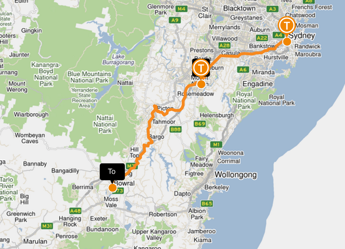 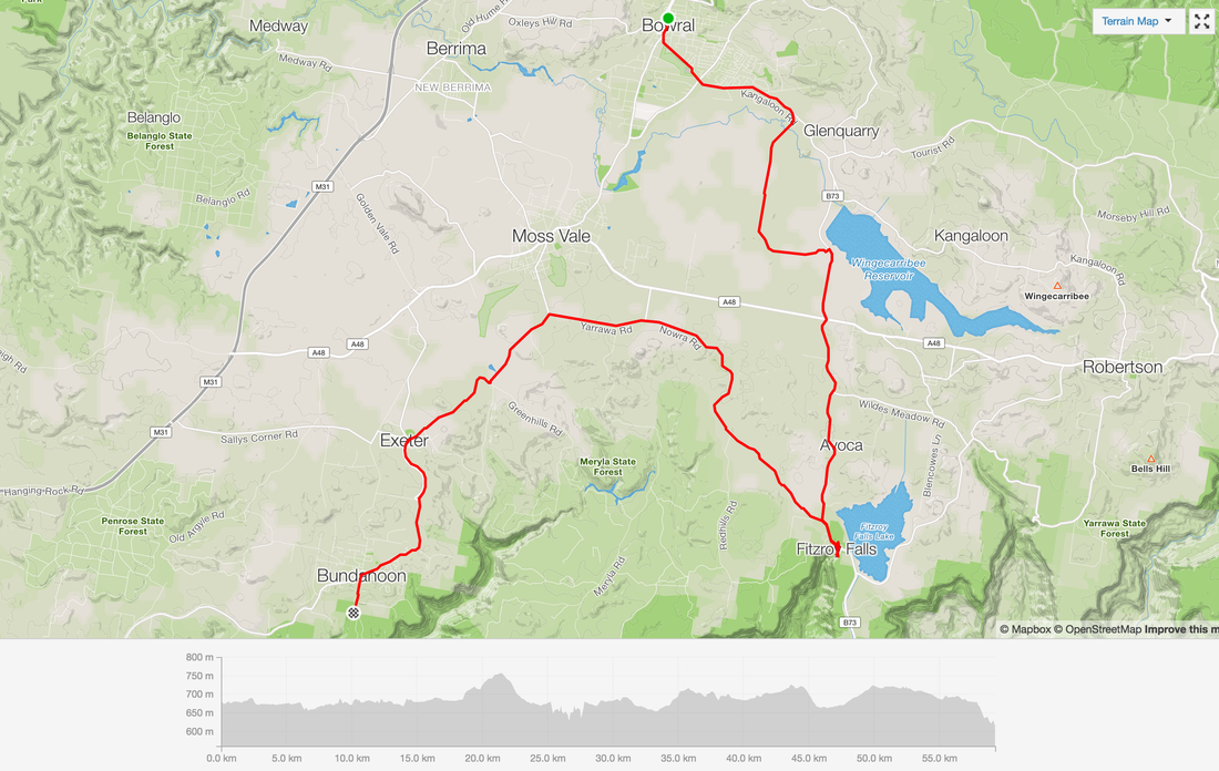 Day 1 - Bowral - Fitzroy Falls - Bundanoon Distance: 59 Kms Strava: link Pit Stop 1 - Bowral - Gumnut Patisserie At Bowral we rolled into the Gumnut patisserie for a pre ride coffee and a multi award winning pastry. Pit Stop 2 - Someone's farm Goggle maps took us through someone's private property but it was a short 100 m sneaky pass. We figured we weren't going to be long. So shhhh. Pit Stop 3 - Fitzroy Falls & Lunch Mini hike around the top of the falls and a perfect spot for lunch. Pit Stop 4 - Exeter train station A quick snack break sitting at the Exeter train station only needed to move once for the freight train. Pit Stop 5 - Camping - Bundanoon - Gambells rest site Bookings essential details here. Limited number of sites available here. Cost: From $25 a night Facilities: Hot (gas) showers, flushing toilets, gas stoves, taps Dinner - Eggplant & tofu stirfry Ingredients: 1 massive eggplant, packet of firm tofu, 4 packets of 2 minute noodles, cabbage, onion, soy sauce, ginger, cooking oil spray. Marinate the tofu. Fry up the onion and eggplant on the stove. Cook the noodles. Cook the tofu. Once the noodles are cooked, mix everything on the stove top. Bundanoon Night Ride to the Glow worm cave In the dark surrounded one of the crew recited a beautiful Arabic poem by Ibn Arabi, I follow the religion of Love whatever way Love's camels take that is my religion and my faith ابن عربي - أدين بدين الحب 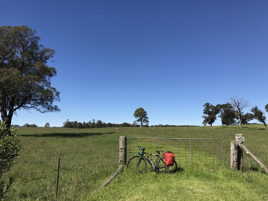 Day 2 - Hiking around Bundanoon Lazy morning, slow to start. Pancakes on the stove top lathered in blue berry jam. There are plenty a hiking trails in the Morton National Park. We Day 3 - Easter Sunday - Bundanoon - Berrima - Bowral Distance: 40 kms Strava: link Kicked Easter Sunday watching sunrise over Morton National park, followed by another epic feast of pancakes. Pit Stop 1 - Bundanoon Markets Packing down and heading into Bundanoon to sip coffee at the cafe and check out the local markets. Picking up a few goodies at the local op shop and sampling some delish vegetarian Indian goods. Pit Stop 2 - Berkelouw Book Barn Lazing about reading in the sun lying on the beautiful grounds of Berkelouw Book Barn. Perfect ending to a beautiful Easter break. 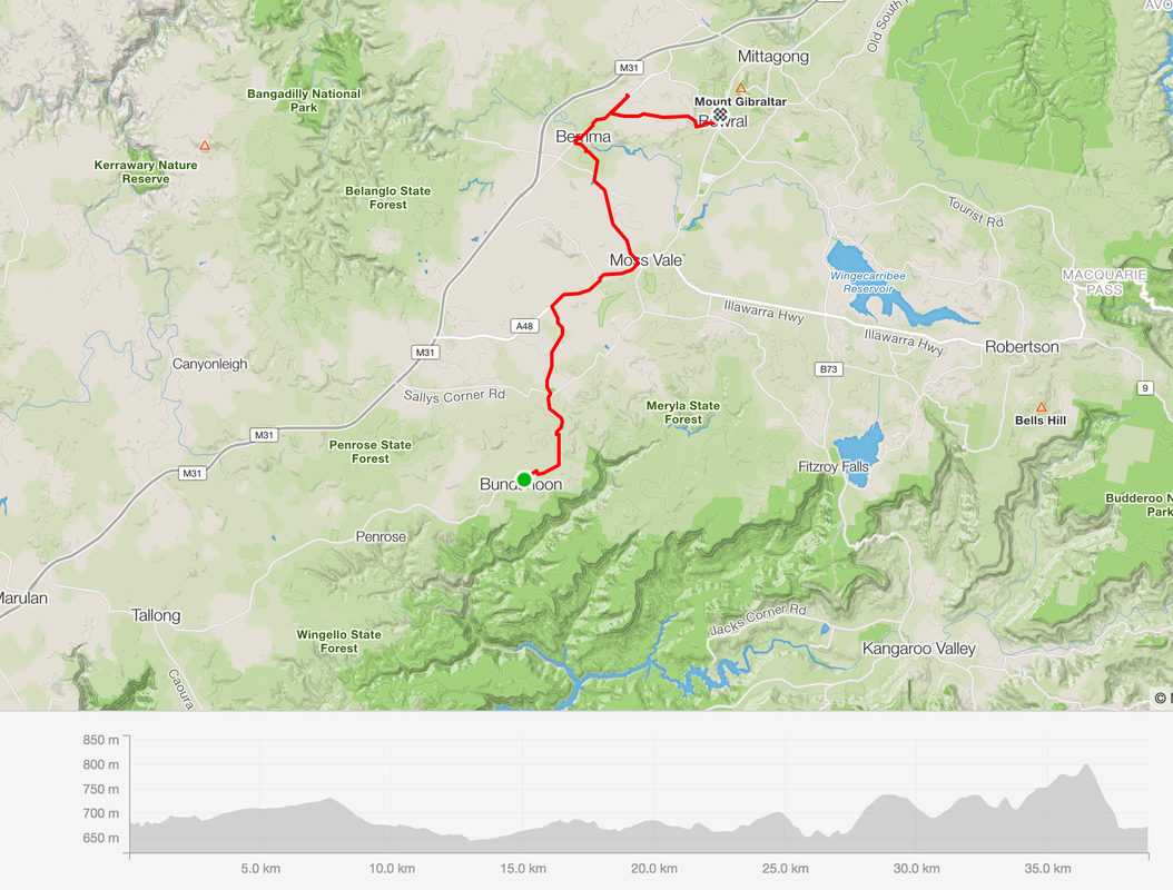 liFinal stats Total Distance: 622 kms Total Elevation gain: 7,760 m Highest Peak:1,500 metres above sea level at Selwyn Snowfields Coldest point: Selwyn Snowfields, 6 degrees, felt like 1 (evidence in the ice that formed in our drink bottles) Fastest speed: 59 kms/h Fires we made or leeched off others: 6 Successful dampers made by the fire: 0 Muesli bars consumed: 14 Favourite moment: Riding with a brumby Least favourite: All the gravel View the posts for the whole journey: link Posts Day 1 - Moss Vale to Bungonia - link Day 2 - Bungonia to Canberra - link Day 3 - Canberra to Mount Clear via Bobeyan Road - link Day 4 - Mount Clear to Selwyn Snowfields - link Day 5 - Selwyn Snowfields to Tamburamba - link Day 6 - Tamburamba to Jingelic - link Day 7 - Jingelic to Albury - link Ride with GPS Day 1 - Moss Vale to Bungonia - link Day 2 - Bungonia to Canberra - link Day 3 - Canberra to Mount Clear via Bobeyan Road - link Day 4 - Mount Clear to Selwyn Snowfields - link Day 5 - Selwyn Snowfields to Tamburamba - link Day 6 and 7 - Tamburamba to Jingelic - Albury - link 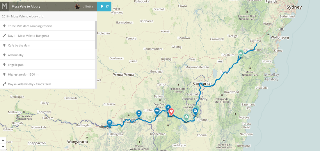 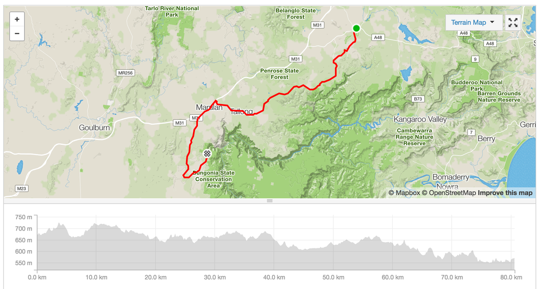 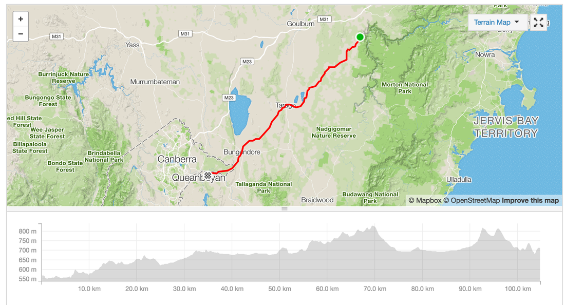 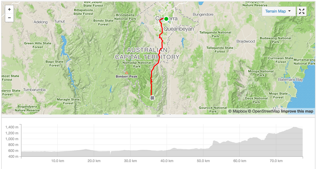   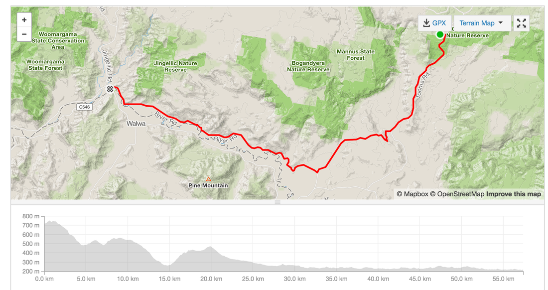 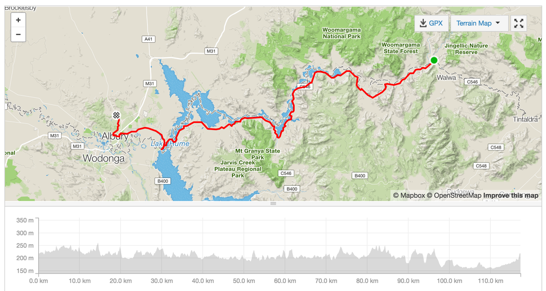 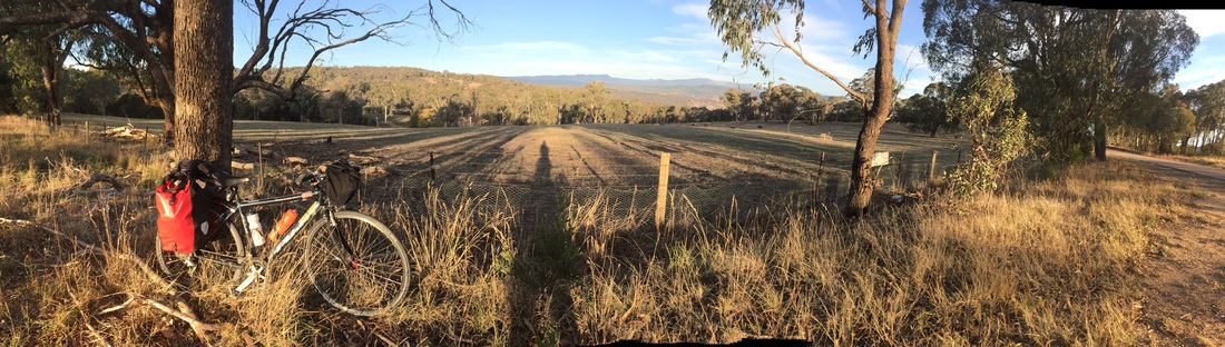 Waking up to a frozen drink bottle isn't so bad when you're camping lake side and it's all misty when you wake up to the sun rising. Our neighbours are super helpful again showing us their topographical map with contours of the mountain ranges and then donating 4 litres of water. Much appreciated as we had our massive climb on a hot day. Distance: 63 km Elevation: 1,207 m Strava: link Warning: no water stops along the way. Highlights:
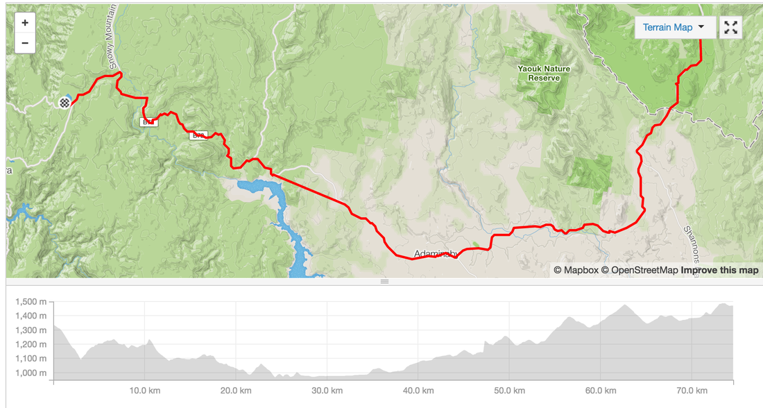
 Wake up after a freezing cold night. Luckily we have enought fuel for a fire to warm some water to make porridge. However the gravel road out of Canberra along Bobeyan road is soul crushing. Our patience is thinning. We're not talking to each other and ready to burst. We make it out by 12pm and roll into Adaminaby for lunch. We sit eating in the fallen Autumn leaves planning the next section. We thought we'd be able to make it to O'Hare's rest area, but as the sun went down and still had 30 kms to go we realised there'd be no chance. Plan b get to a warmer flat ground, outta sight camp-able spot before we freeze. Hangry and cold we pass a sign for Selwayn Snowfields and come across a sign with the tent symbol, Three Mile Dam camp grounds. SCORE! We roll in and see several campervans with fires going and we're more at ease. The night gets better as we get invited to share the fire of our neighbouring campers who also have keen cycling children and are keen adventurers. Another close call. Distance: 74.5 kms Elevation: 1,478 m Difficulty: Hard Road: Gravel 43 kms, on road, beautiful decent into Kiandra goldfields Strava: link Start: Mt Clear End: Three Mile Dam Campground near Selwyn Snowfields Food: Lunch @ Adaminaby, cafes, bakery, pub, bowling club, general store with camping gear Highlights:
Anit-highlight
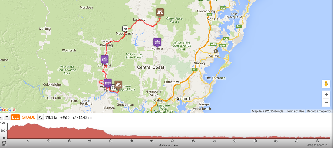
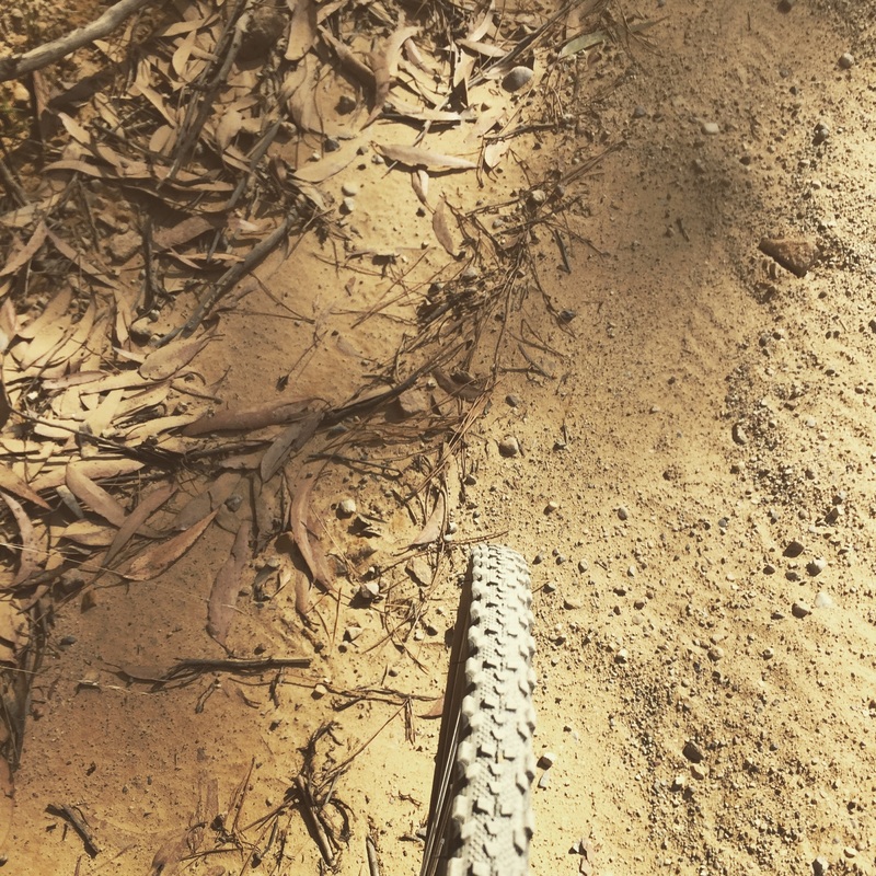
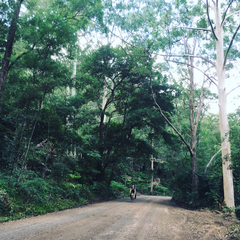
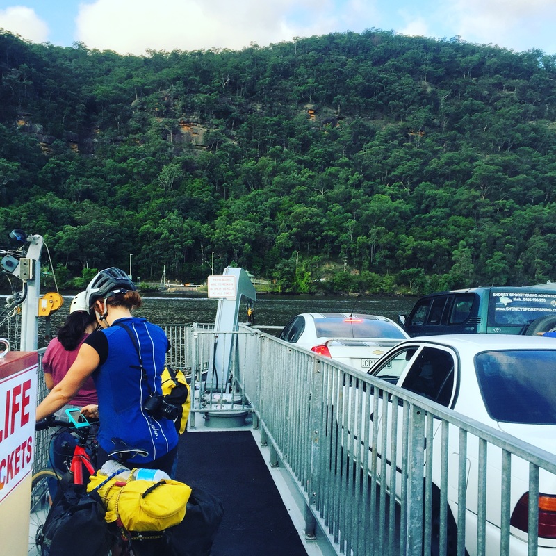
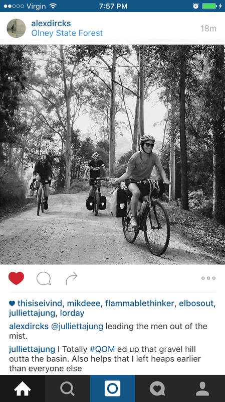
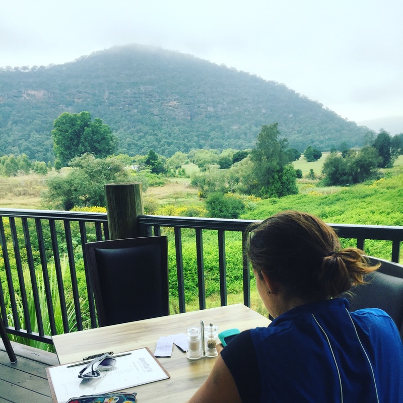
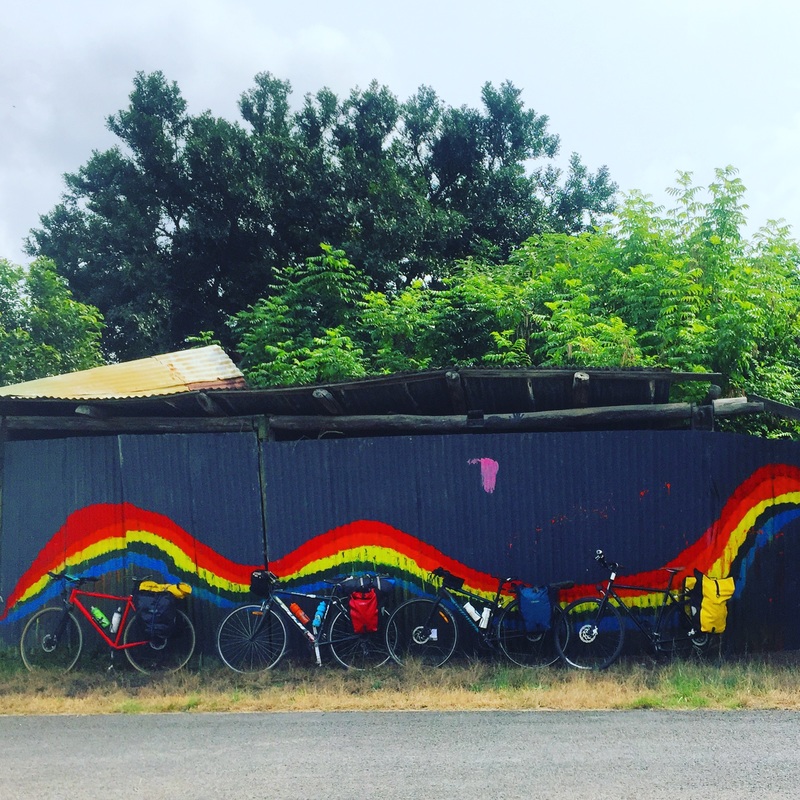
 I ate a lot of dust this weekend. Actually only when I was riding on the dirt, gravel, corrugated gravel, off road roads. There was much anxiety and fretting over whether my Fuji hybrid would be able to handle the Easter tour. Eventually I borrowed some knobbly tyres from a friend, switched them onto my Fuji, strapped on my tent and borrowed panniers on another cycle touring adventure. Day 1 - Wyong to the BasinRoute: link Distance: 77 kms (if you go to the cafe) 67 kms (if you don't go to the cafe) Elevation: 1308m Road conditions: Dirt, gravel, bitumen, corrugated gravel, down hills, ditches, everything Start: Wyong station (catch a train from Central station 2 hours) Finish: Basin camping, Olney State Forest 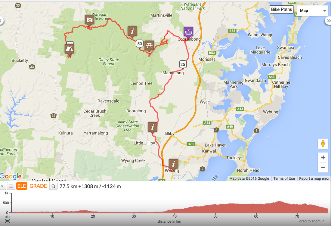 Day 2 - Basin to Wiseman's ferryRoute: link Distance: 78 kms Road conditions: Gravel hill out, undulating dirt roads, corrugated gravel road, bitumen, free ferry to Wiseman's ferry, another ferry to Mill Creek camping grounds Start: Basin camping ground Swim stop: St Albans Lunch: Settlers Arms pub, St Albans with live music Finish: Mill Creek Campaign ground, 6 kms from Wiseman's ferry Highlights:
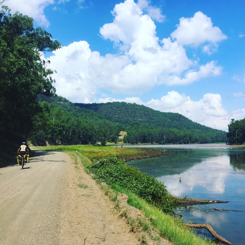
 Day 3 - Mill Creek to WindsorRoute: link Distance: 60 kms Road Conditions: Bitumen, mostly along the Hawkesbury which doesn't see much traffic. Start: Mill Creek camping grounds Coffe: Wiseman's ferry cafe Lunch: Sackville ferry stop, packed lunch Finish: Windsor station Beware: Bogan redneck drivers and houses with the Eureka flag Highlight: Riding along the Hawkesbury river 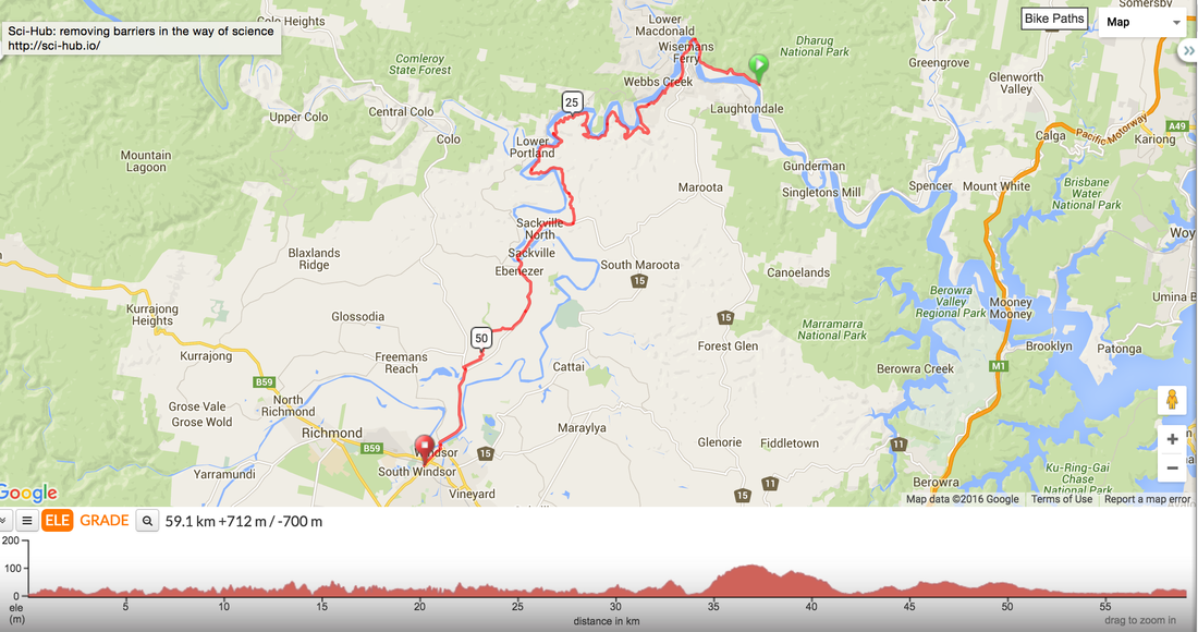 |
Archives
July 2023
Categories
All
|


 RSS Feed