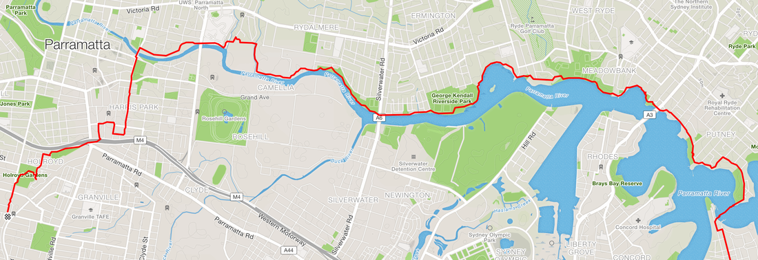
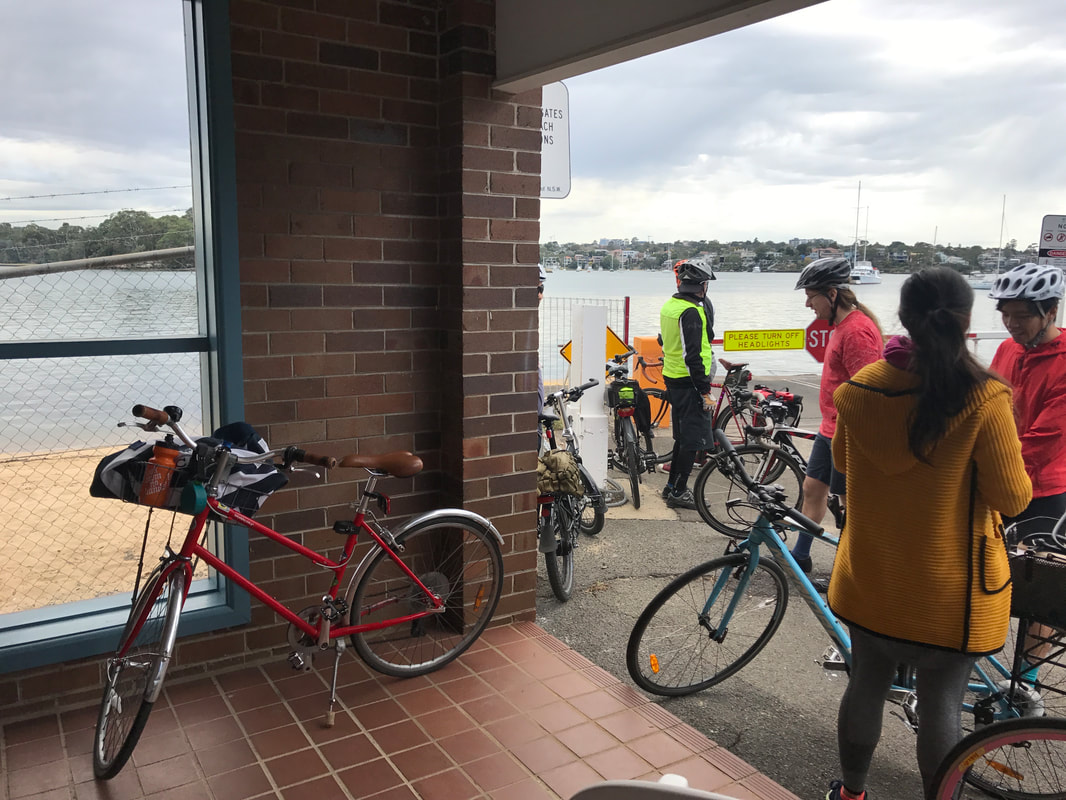
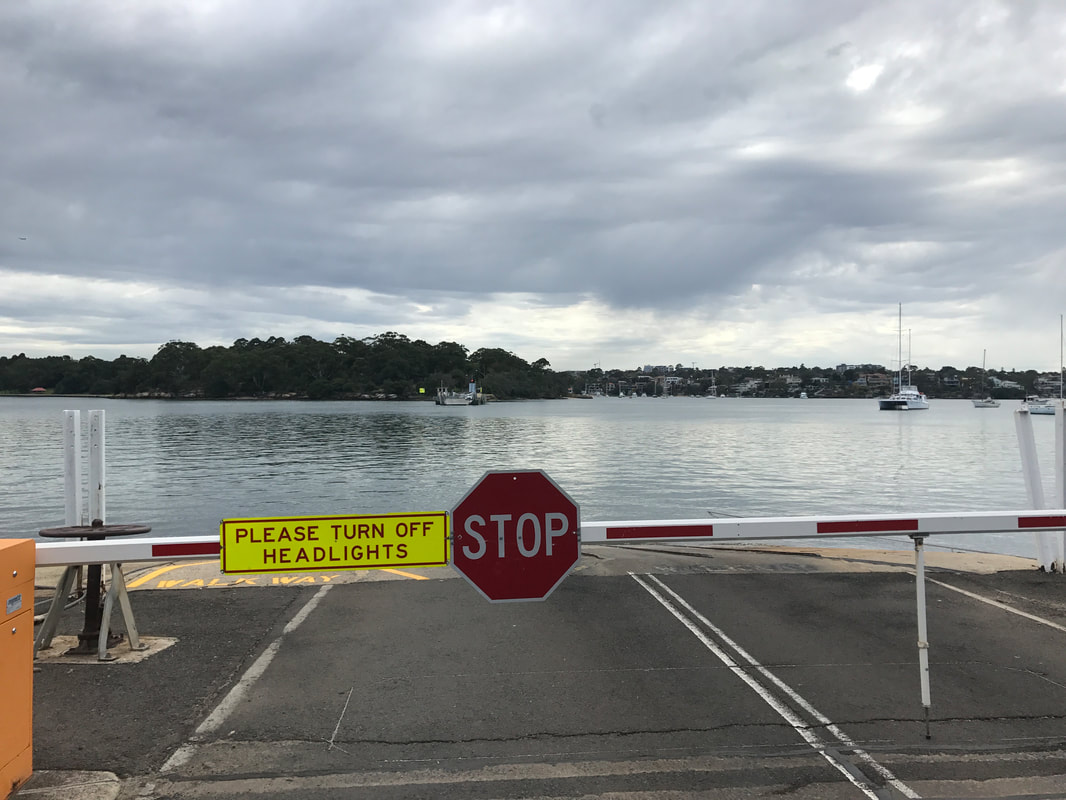
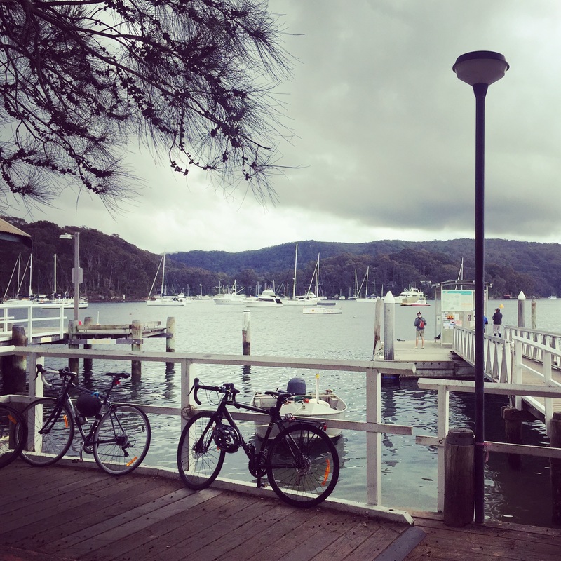
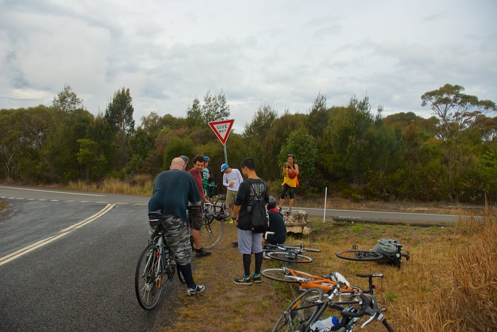
 It's now possible to ride or walk off road for 10 kms along the northern side of Parramatta river (Parramatta to Putney)! Thanks to a new bridge across Subbiaco creek the shared path allows people to travel safely to and from Parramatta without ducking into the industrial areas of Rydalmere. Before Subiaco creek connection Bike riders would have to ride 500 metres on road in an industrial area between Rydalmere and Parramatta. It's not much, but it's still off putting enough for those with children and not confident riding in traffic. 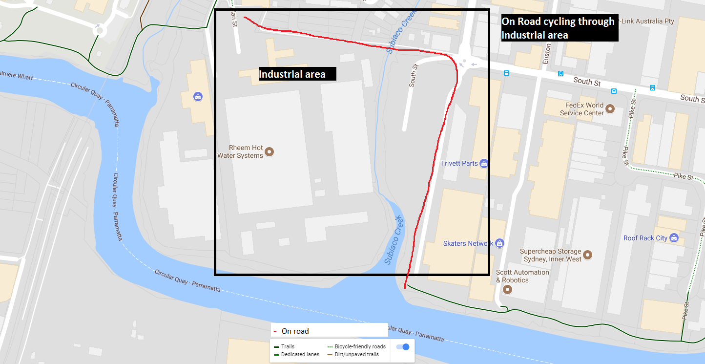 After Subiaco creek connection Bike riders can ride off road, along the river for 10 kms from Parramatta to Putney! 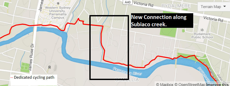 I took the opportunity over the weekend to travel from the City to Merrylands (Check out the post on Sydney Nom Rides). The route was half on road cycle path and off road, and interestingly included a "punt" (a ferry to transport vehicles and people) across Parramatta rived between Mortlake (Breakfast point) and Putney. The Putney punt has been operating since 1925, it's free of charge to use, operated by RMS. Operates all day on weekends and only during peak hours on weekdays. It's basically a platform on cables that moves back and forth by 2 operators and was built because it was cheaper than building a bridge. Check out the Strava link for route details. 
0 Comments
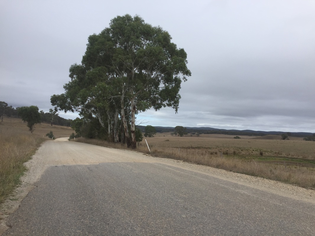
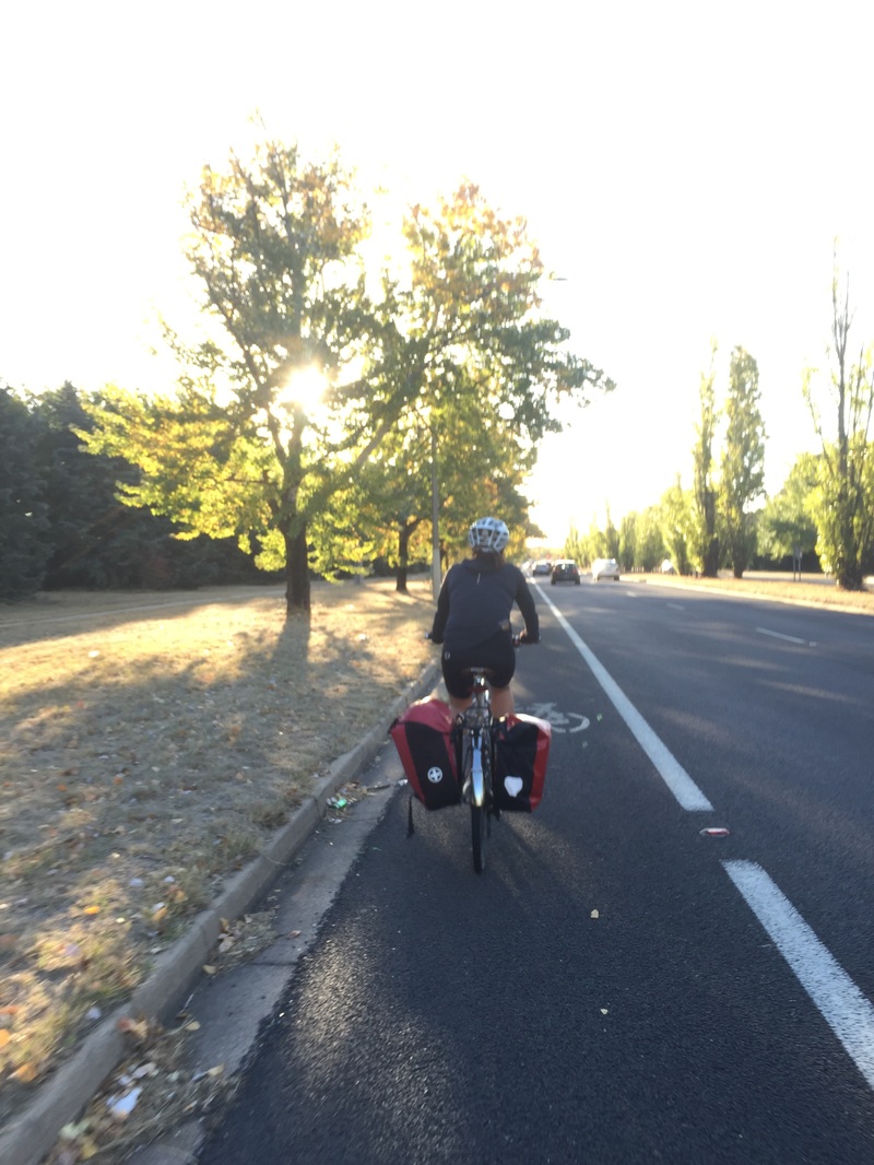
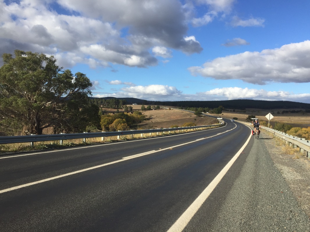
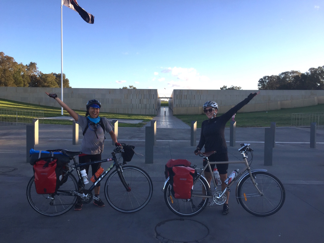
 Route: link Strava: link Distance: 124 kms Elevation: 1100 m Start: Bungonia Campground End: Canberra bus depot Road: On road, some compact dirt with corrugations (not much not too bad) 20 kms on highway with small shoulder, in Canberra bike lanes Difficulty: Medium - Hard (highways weren't too pleasant) Highlights:
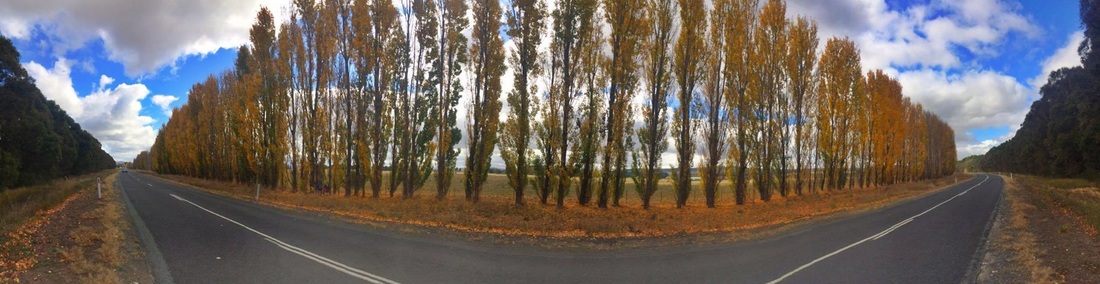
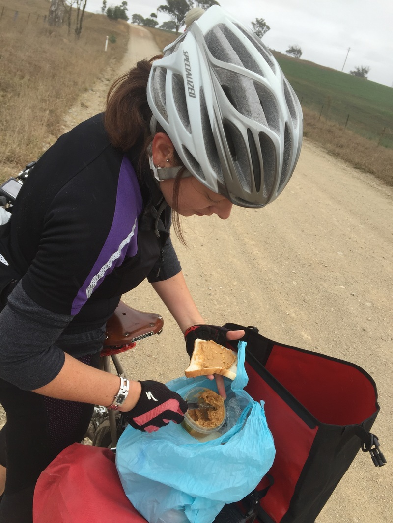
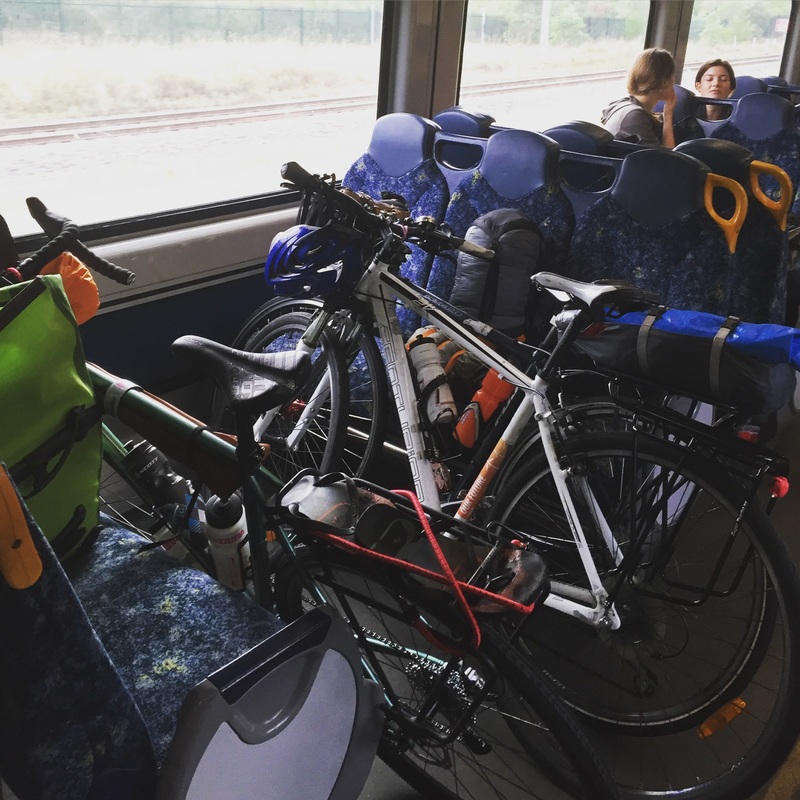
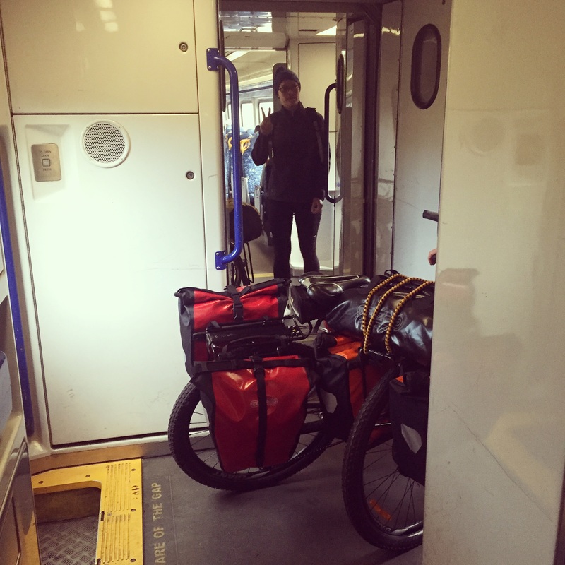
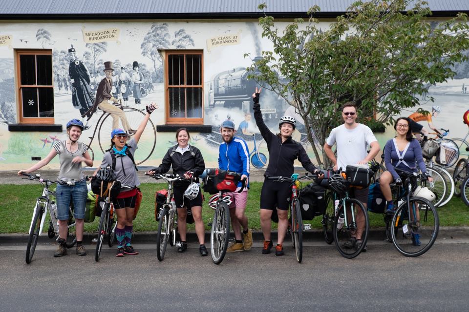
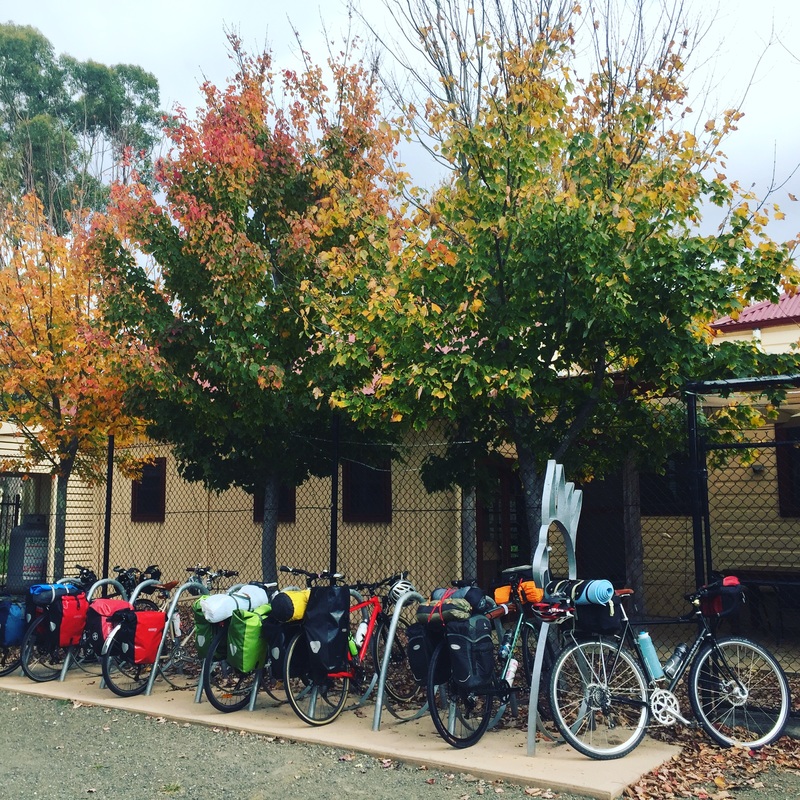
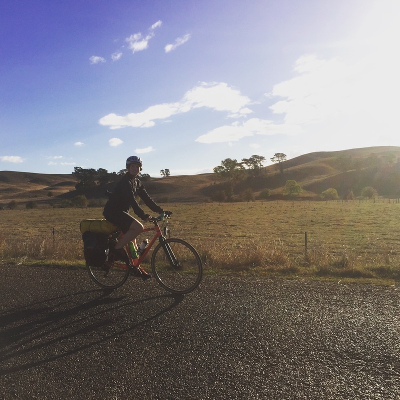
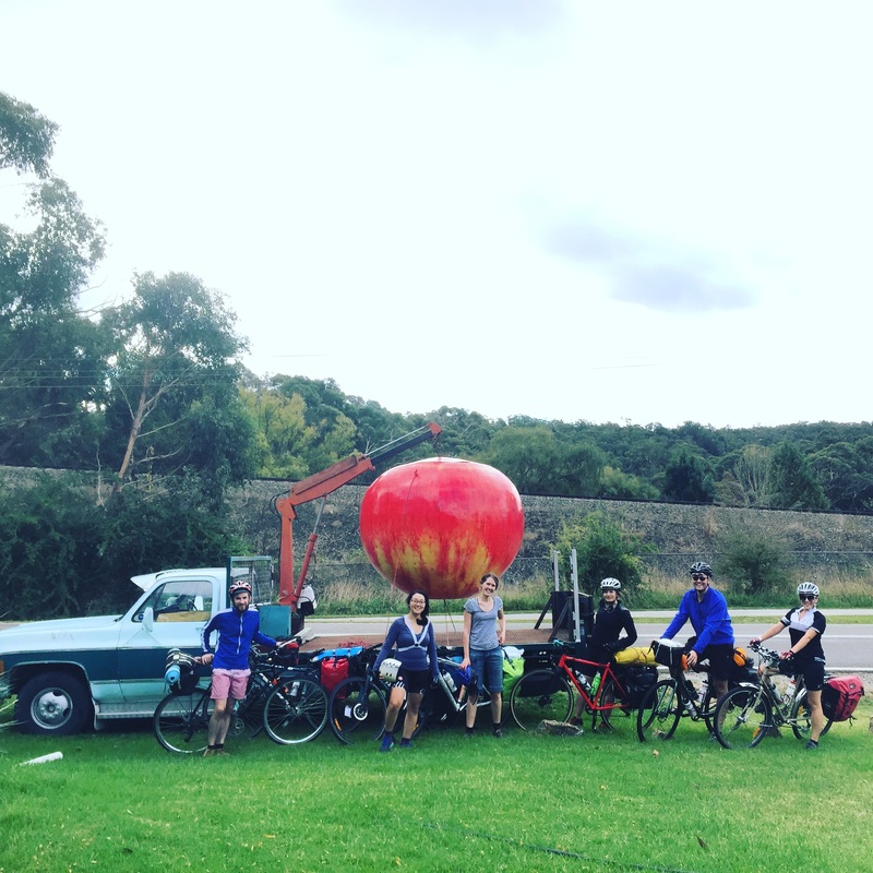
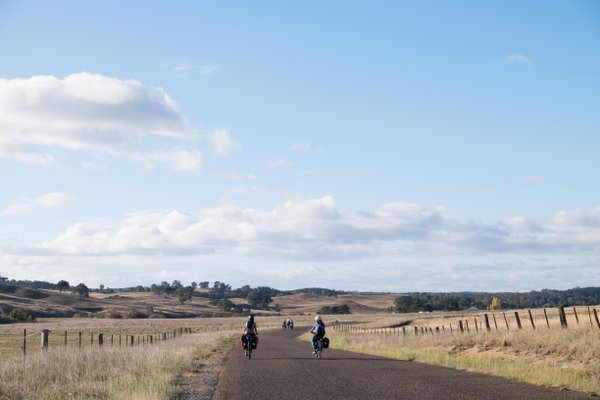
Panorama photos courtesy of J.Henderson. 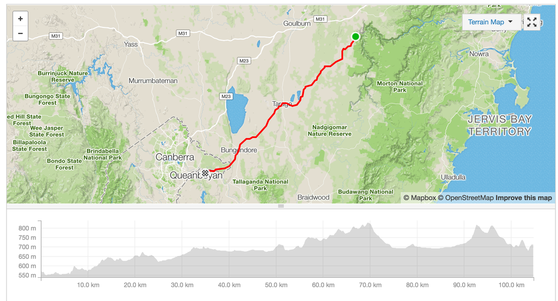 It's long weekend and I'm in between jobs so I figured I'd take this opportunity to do a cycle tour down through NSW. What started off as an idea for an overnighter turned into a week adventure through the Australia's highest mountain ranges in Kosciuszko National park. I managed to convince 5 others to come along on the first part to Canberra, a mini adventure with the SNR crew. After much planning between myself and a friend, lots of consultations of train times, locations, camping grounds. We finalised a route from Moss Vale to Canberra via Bungonia. The adventure began at 7:24am from Central station, trying to find the elevator up to the platform is a nightmare (go to the Eddy Ave side first). We caught a "normal" 8 carriage train out to Campbelltown then changed over to the train for Moss Vale. Although the train ride was completely covered by the opal card, we didn't realise the train to Moss Vale was very different to the Sydney trains. It was 2 carriages, had space for 2 bikes to hang off a hook and no in between spaces. Somehow we managed to squeeze bikes into the passenger part and lie them ontop of each other. Train ride duration: 2h 30 mins Start: Central Station End: Moss Vale Station Ride Start: Moss Vale Station Ride End: Bungonia State Forest Camping grounds Distance: 79 kms Elevation: 730 m Difficulty: Easy, Medium Road Conditions: On Road (bituman) in back countries, 10 kms on highway with wide shoulder Route Map: link Strava: link Moving Time: 4h 30min Total journey time: 6h 20mins Pitt Stops:
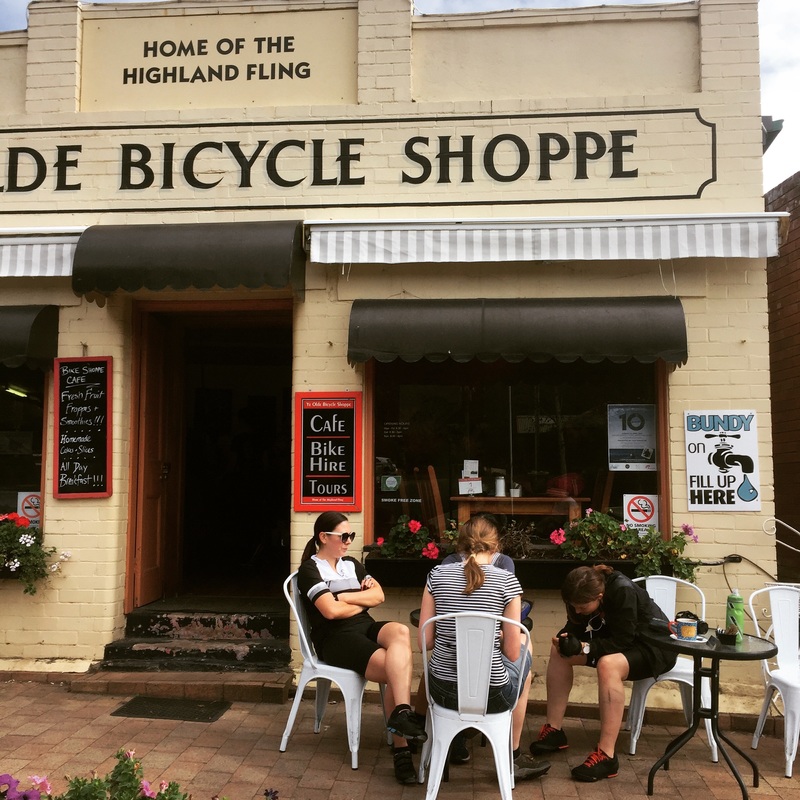
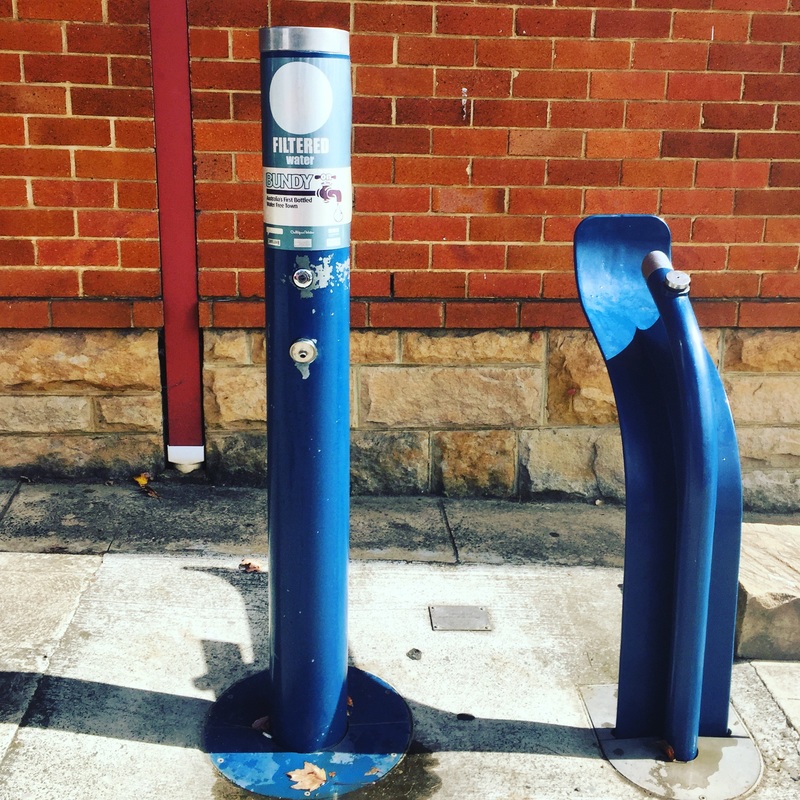
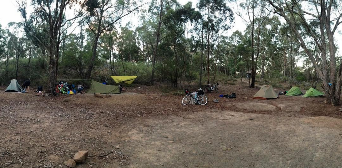
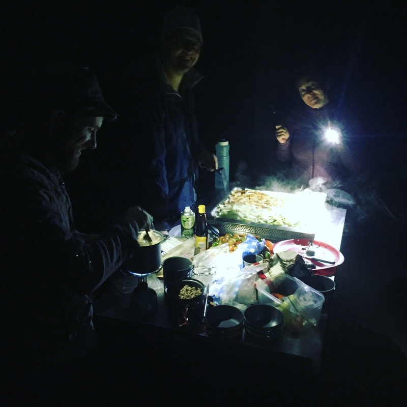
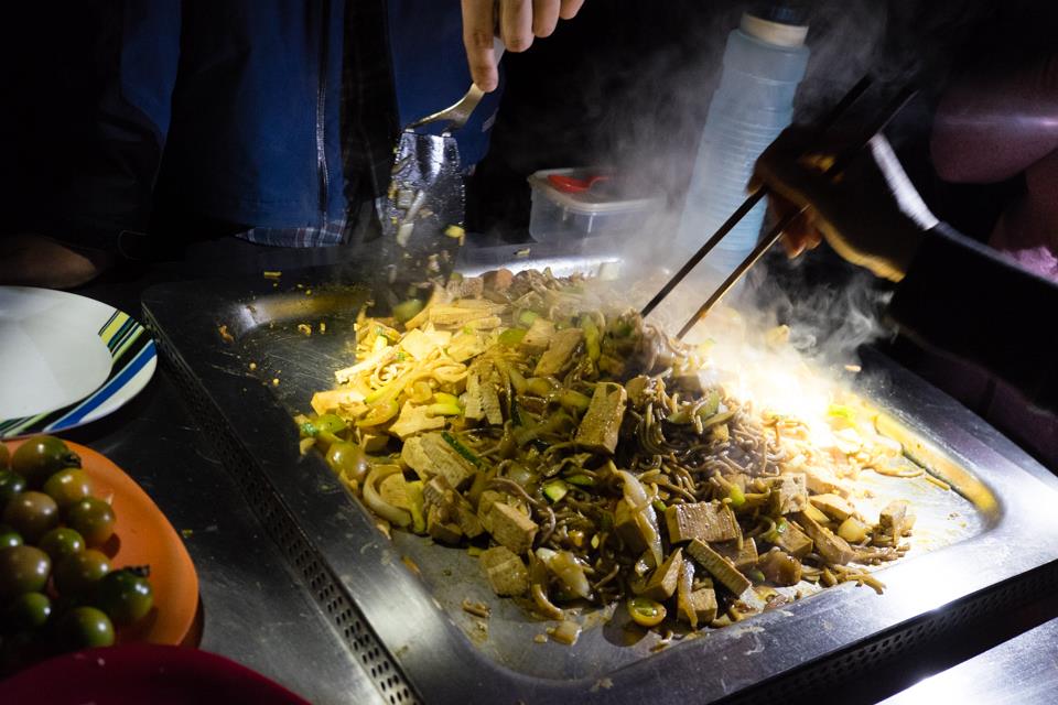
Camping site: Bungonia Campgrounds, booking required and has charges. Facilities are out of this word. Filtered water, hot showers, gas bbq outside, gas stoves in an common room Highlights:
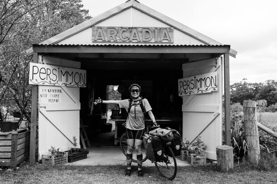
Some photos courtesy of this beautiful rider @alikjones 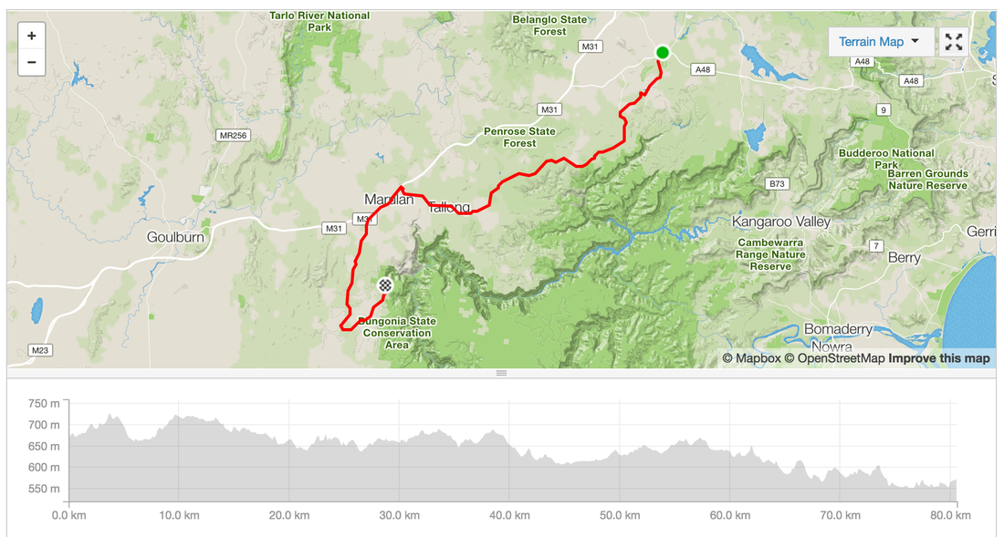 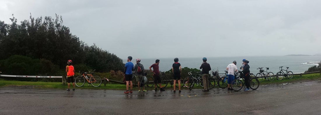
Photo Courtesy of Mr. Rayner
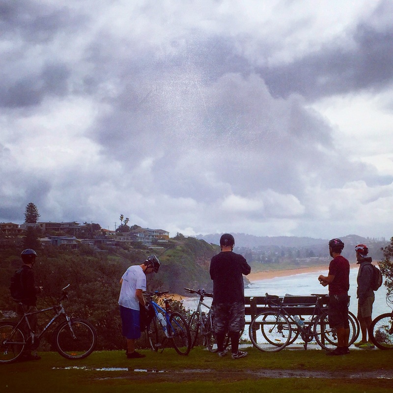
Distance: 54 kms
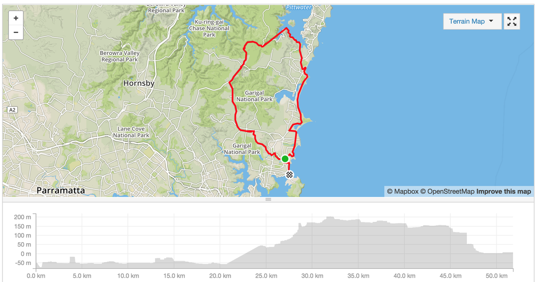
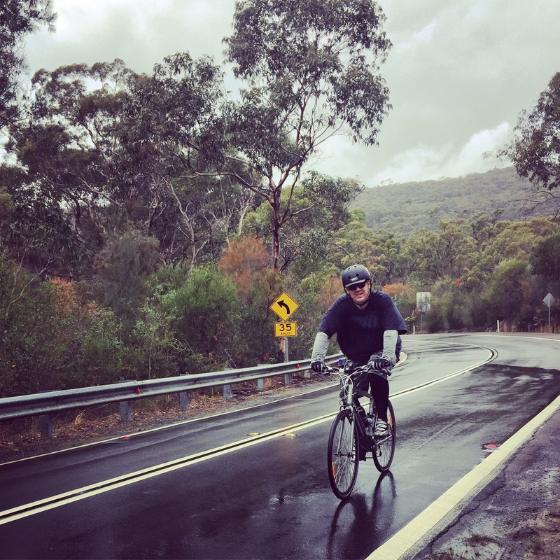
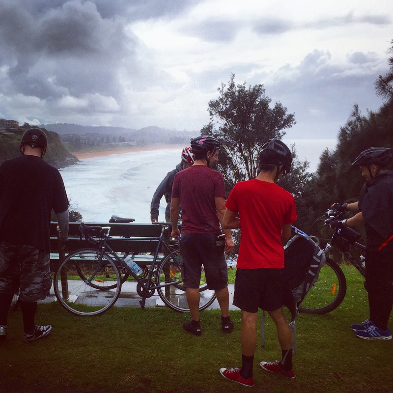
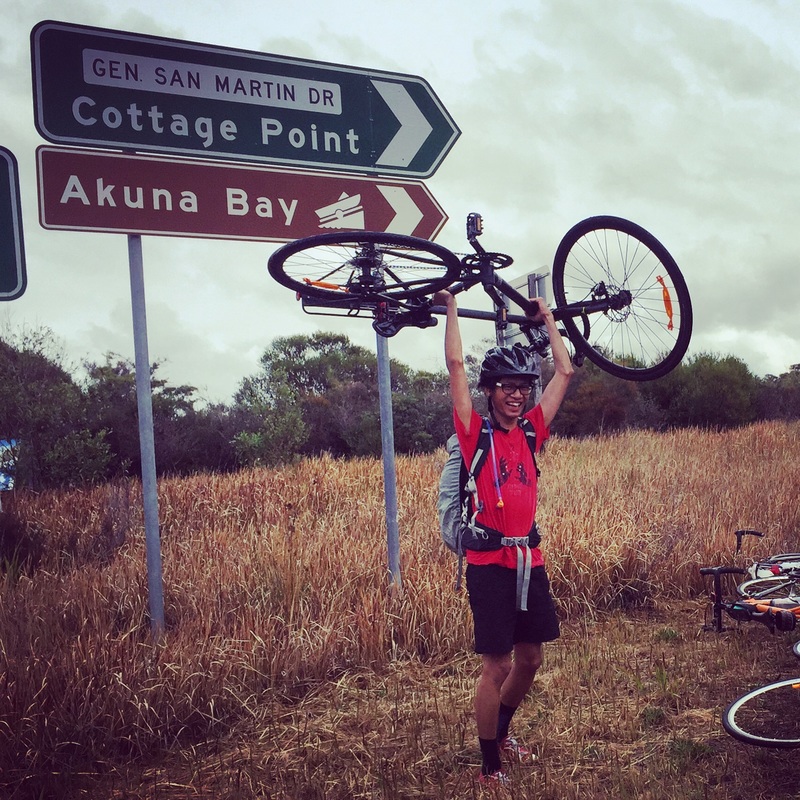
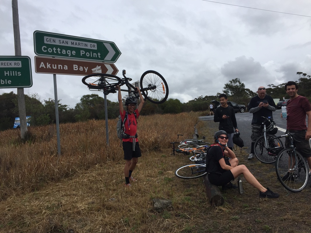
Time: We took about 3 hours to do this with several stops to take photos and get some snacks Route: Manly, Freshwater, Dee Why, Collaroy Beach, Warriewood Beach, Mona Vale, Narrebeen, Church Point, Ku-Ring-Gai Chase National Park, Terry Hills, Allambie Heights Path: Road with bike friendly lanes/sections. In the suburbs along the beach it's quiet but some roads are busy. The busy roads have "bike shoulder lane" Hills: YES Several hills. Be prepared MapMyRide: http://www.mapmyride.com/routes/view/761694601 Strava: https://www.strava.com/activities/385848745 Sights:
Tips:
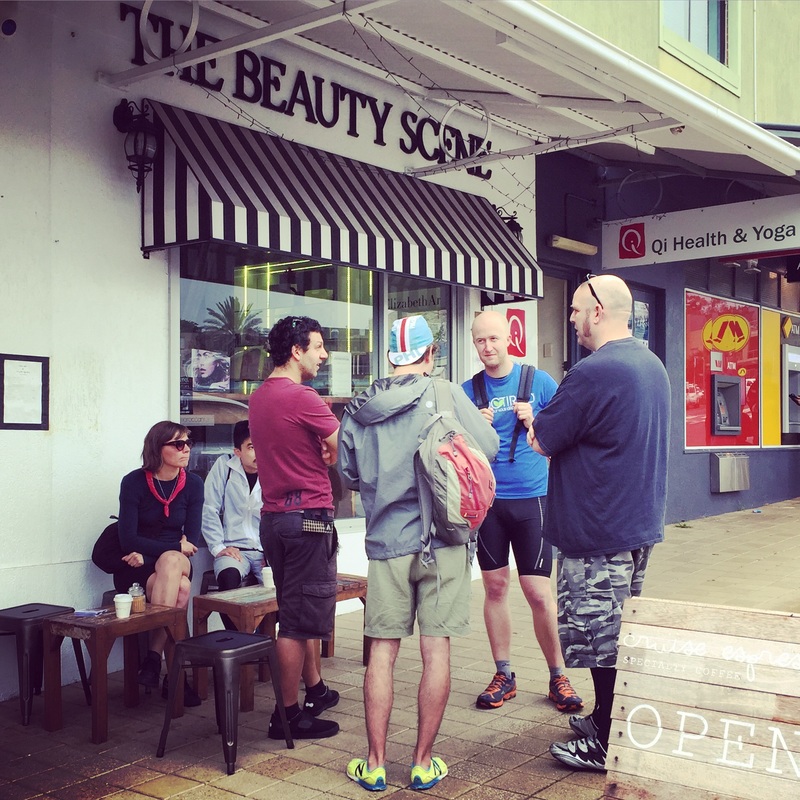
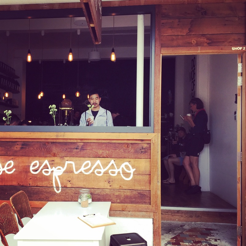
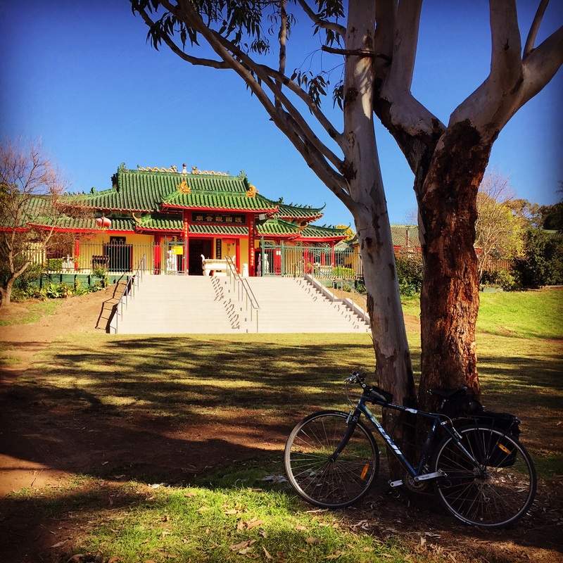
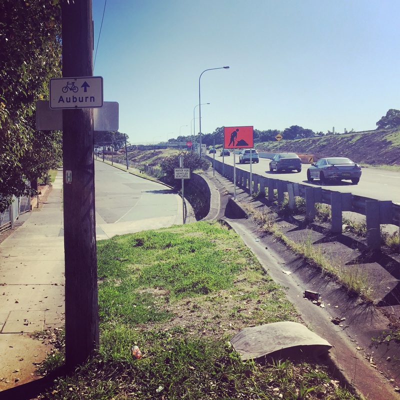
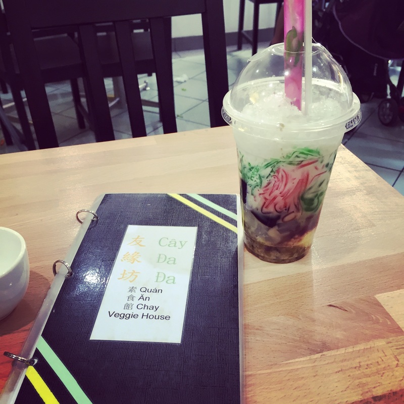
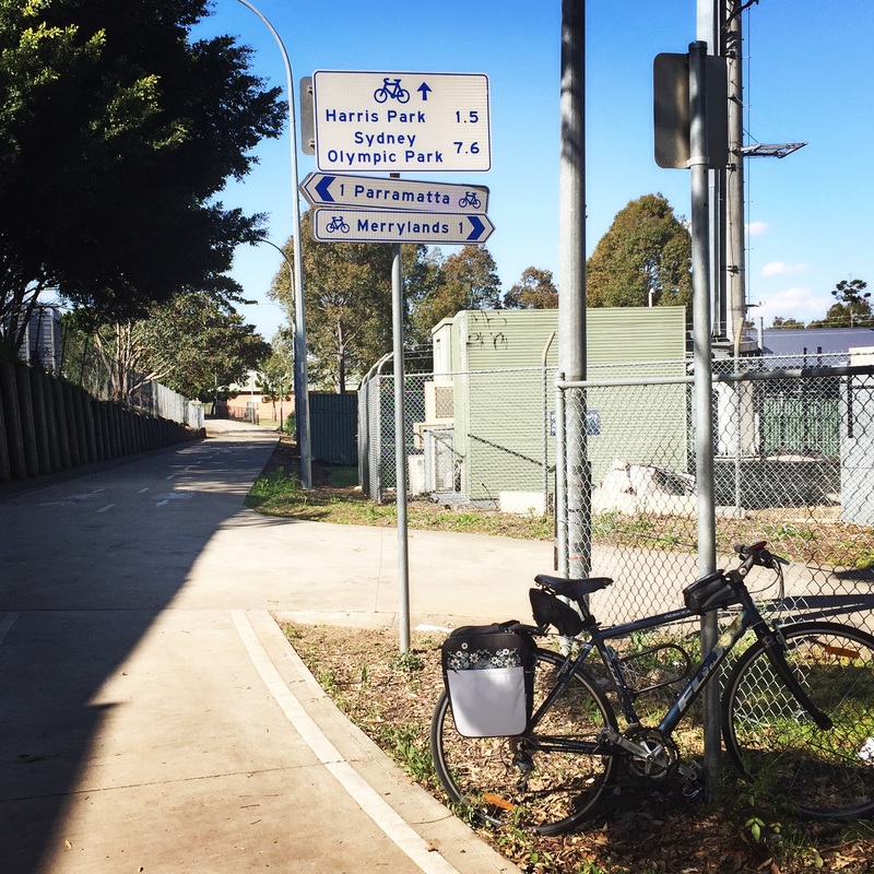
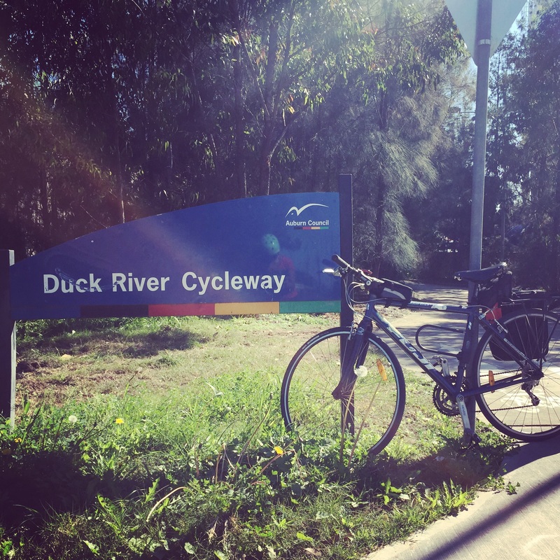
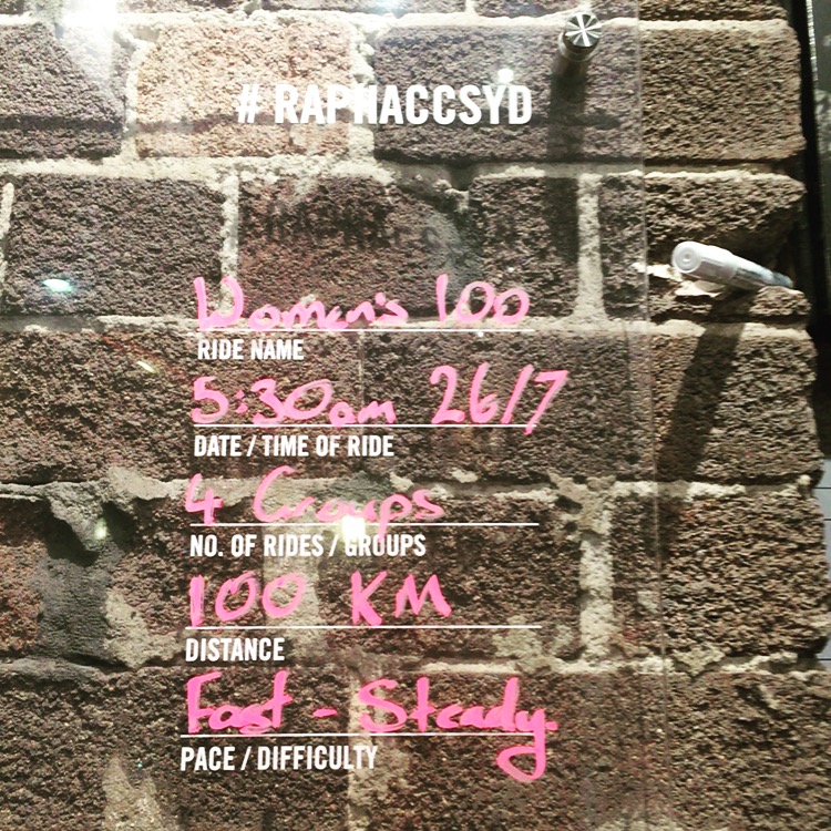
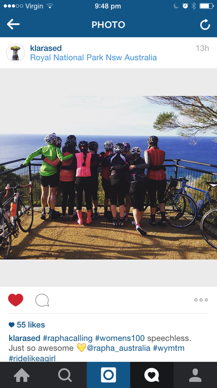
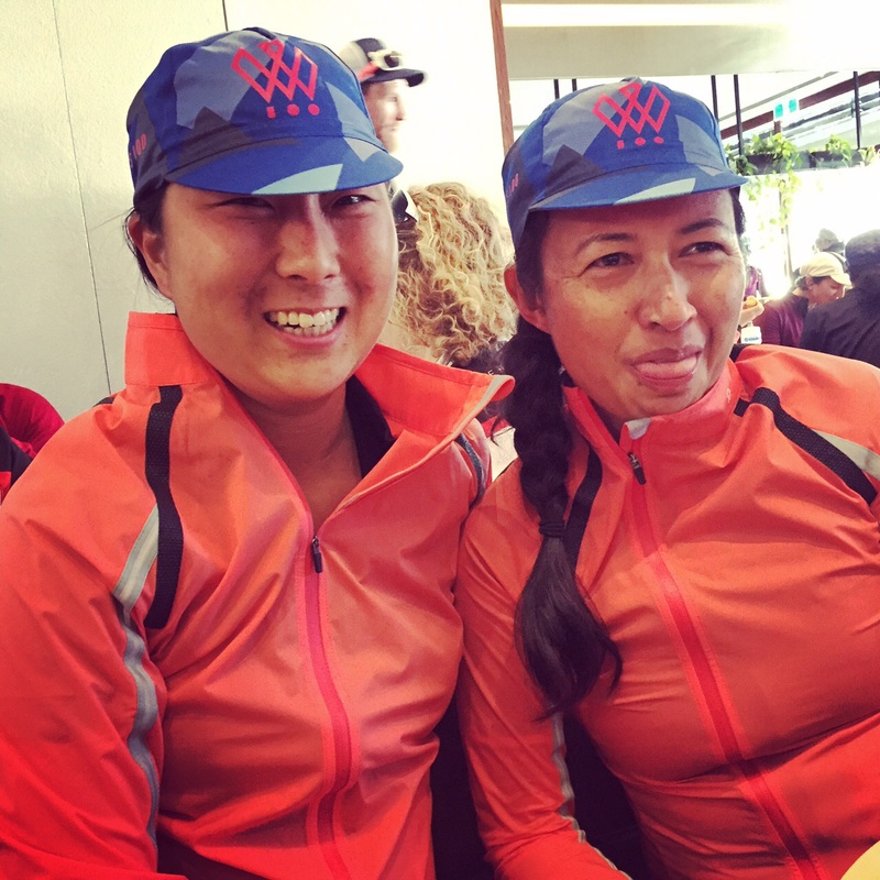
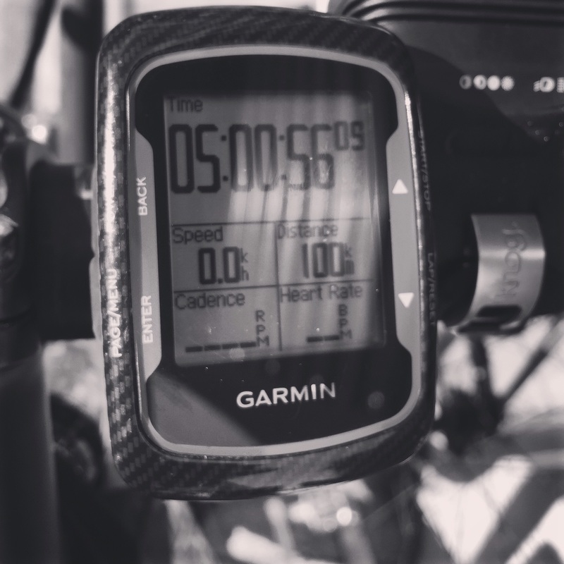
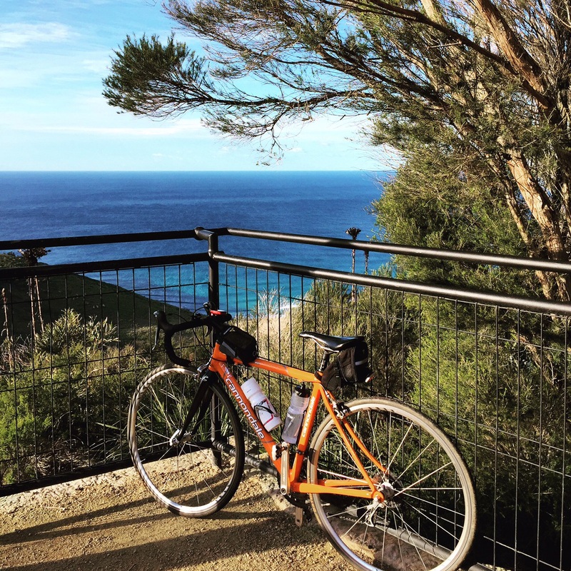
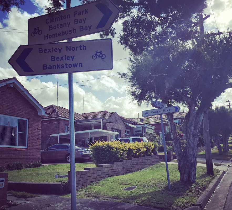
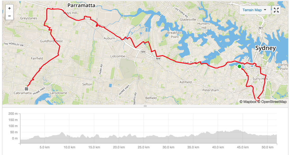 The M4 Cycleway is surprisingly very well signposted, even with the detours the diversions signs were everywhere. The best part of this ride is the destination. Cabramatta, home of the best Vietnamese food. Distance: 50kms Route: Glebe - Zetland - Sydney City - Lilyfield - Haberfield - Olympic Park - Auburn - Harris Park - Wentworthville - Fairfield - Cabramatta Path: Mostly Cycleways, separated paths, some bike friendly roads in the city Hills: Only a few with small gradients Strava: link Sights: Buddhist temple near Cabramatta station along the cycle way Treats: Cabramatta offers the best selection of Vietnamese food, check out this blog for a map. Also because of the strong Buddhist culture there are several vegan/vegetarian Vietnamese restaurants as well. Must try: 3 colour bean drink (Che Ba Mau) Another amazing night ride through Sydney. Distance: 20 kms Difficulty: A few hills Views: Amazing views of the city skyline from Balmain and ANZAC bridge Best part: Riding under the ANZAC bridge in the Wharf area and coming out to a view of the harbour bridge MapMyRide: link Strava Activity: link Strava Route: link 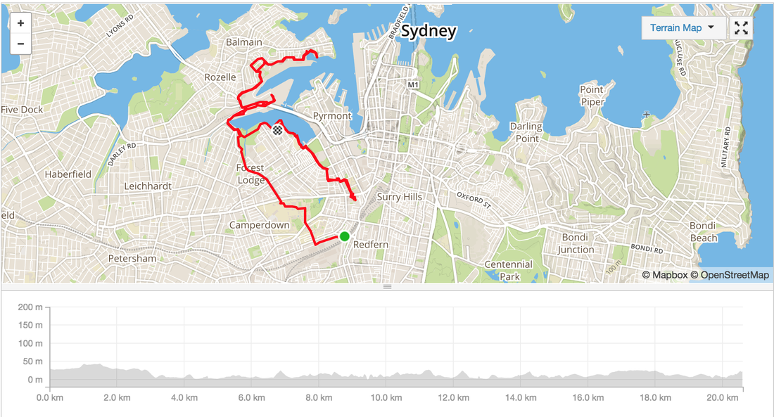 Distance: 40 kms Location: Glebe, Redfern, Rushcutters bay, Double Bay, Nielson Bay, Watson Bay, Dover Heights, Bondi, Centennial Park Difficulty: A few steep inclines, heartbreak hill isn't steep but a bit long Surface: Road, a few stairs Highlights: Amazing views of Sydney Harbour, lots of beaches, spectacular display of Sydney's most expensive houses. Facilities: Cafes, public toilets, water fountains along the way Strava route details: http://www.strava.com/activities/359151700 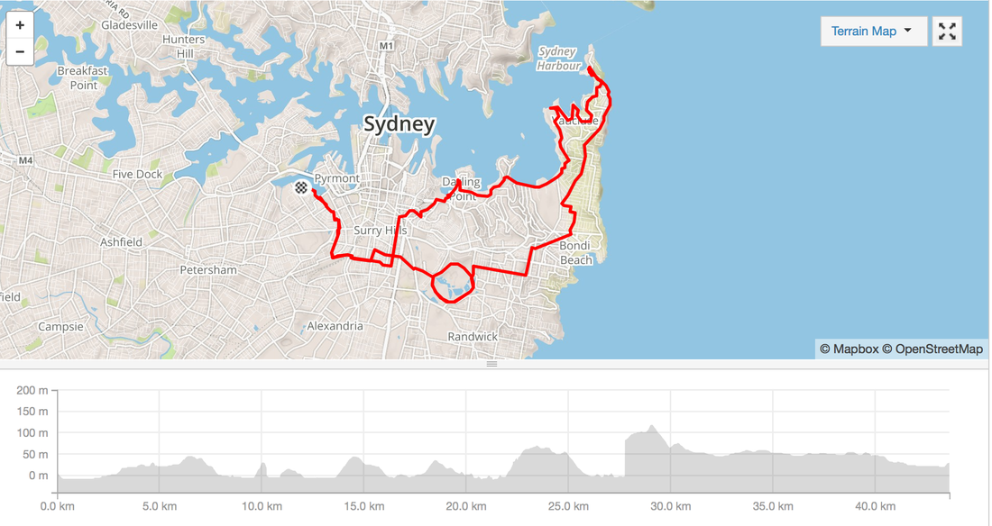 I've been quite anxious leading up to today's Rapha #Womens100 challenge. Thinking that it would be a fast paced pelaton race format. No stops. Lycra. Eating on the bike. I went and bought whole heap of gear to make me feel comfortable (refer to clothing section for more details).Then spent the rest of the week googling ways to pee, change, layer, take off jacket while riding, eating while riding. When all it took was a 15 minutes conversation with the ladies in the riding group. Route details: http://www.strava.com/routes/2760039 Distance: 100kms Difficulty: 3 major ascents and 3 descents. Some roads are tight through and prone to car rage. Surface: Road Facilities: Public toilets at the end inside the National Park. Toilet at Waterfall train station. Otherwise bush. No water refill stations. Temperature: 5 degrees C - 15 degrees C Clothing: Full fingered gloves, merino long sleeve, short sleeve jersey, Live Giant bib shorts, knee warmers, Rapha wind breaker, Rapha cap. No undies. No panty liners The Merino was defintely helpful during the descents in the National Park. I did take off the Merino on the climbs. 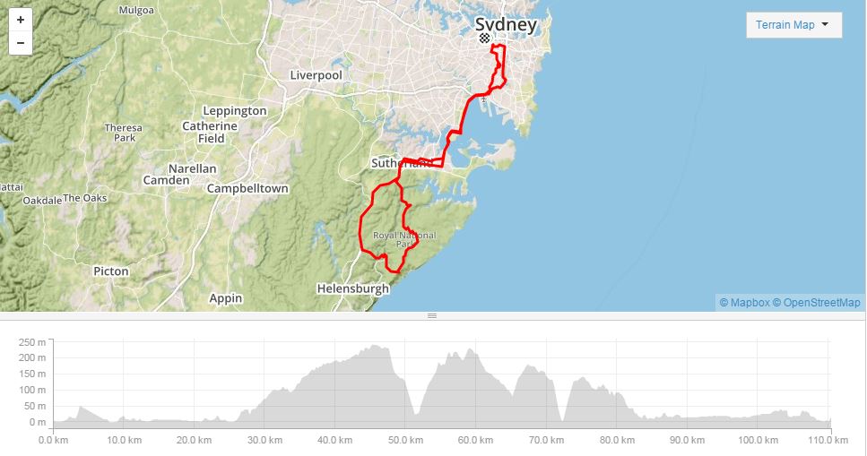 Amazing discovery today. Bike path along one of the nastiest Motorways in Sydney, the M5. Well insulated from the noise with a large embankment it's very safe to ride. Suburbs: Earlwood, Bardwell Valley, Kingsgrove, Beverly Hills, Riverwood Distance: 20 kilometres Road Type: Road, Bike path, some parts are a bit uprooted Difficulty: Only a few hills mostly riding on the bike path. Highlights: 1960s Australian Architecture, single story brick, carports Facilities: Don't remember seeing public toilets Strava: Activity here Related websites: http://www.canterbury.nsw.gov.au/Discover/Parks-sporting-community-facilities/Cycling-Walking-Tracks/Cycle-way-to-Botany-Bay 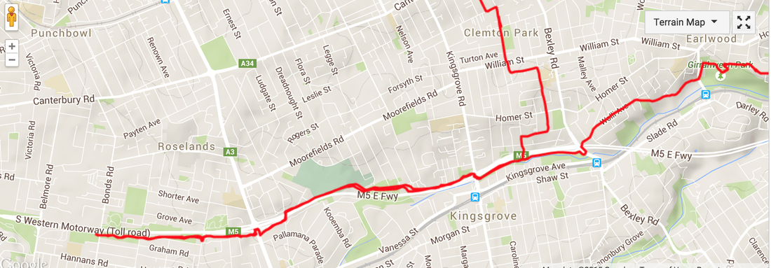  Totally inspired after watching this epic documentary (Bikes v Cars) about passionate cyclists around the world. I'm kicking off some night rides around Sydney. First one will be this Thursday from Redfern. Ride the streets without any traffic or cars. Get a hit of fresh air. Meet new people. Have a bit of fun. Route: 17 km Starting point: Redfern End point: Erskineville for some kebabs and beers Speed: Leisurely Map: google Facebook event: https://www.facebook.com/events/1600736316841321/1601215700126716/ 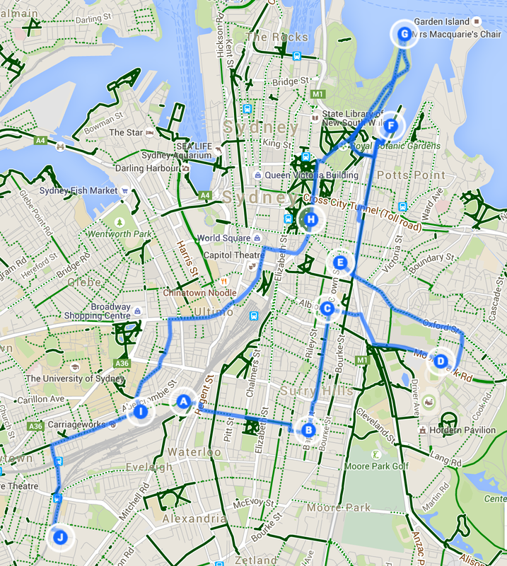 |
Archives
July 2023
Categories
All
|


 RSS Feed